Manambina | |
|---|---|
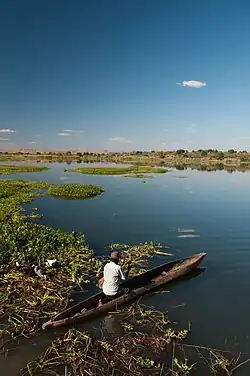 Manambina, on a lake | |
 Manambina Location in Madagascar | |
| Coordinates: 20°5′S 45°29′E / 20.083°S 45.483°E | |
| Country | |
| Region | Menabe |
| District | Miandrivazo |
| Elevation | 92 m (302 ft) |
| Population (2001)[2] | |
| • Total | 7,000 |
| Time zone | UTC3 (EAT) |
| Postal code | 617 |
Manambina is a town and commune (Malagasy: kaominina) in Madagascar. It belongs to the district of Miandrivazo, which is a part of Menabe Region. The population of the commune was estimated to be approximately 7,000 in 2001 commune census.[2]
Only primary schooling is available. The majority 65% of the population of the commune are farmers, while an additional 20% receives their livelihood from raising livestock. The most important crop is rice, while other important products are maize and sweet potatoes. Services provide employment for 5% of the population. Additionally fishing employs 10% of the population.[2]
Roads
This municipality is crossed by the National road 34[3]
References
- ↑ Estimated based on DEM data from Shuttle Radar Topography Mission
- 1 2 3 "ILO census data". Cornell University. 2002. Retrieved 2008-03-09.
- ↑ irenala.edu.mg
Wikimedia Commons has media related to Manambina.
Capital: Morondava | ||
| Belo sur Tsiribihina (16) (608) | 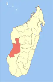 | |
| Mahabo (12) (615) | ||
| Manja (7) (616) | ||
| Miandrivazo (16) (617) | ||
| Morondava (6) (619) |
| |
5 districts; 57 communes | ||
This article is issued from Wikipedia. The text is licensed under Creative Commons - Attribution - Sharealike. Additional terms may apply for the media files.