Marienberg Rural LLG | |
|---|---|
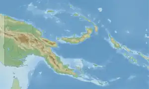 Marienberg Rural LLG Location within Papua New Guinea | |
| Coordinates: 3°57′44″S 144°13′51″E / 3.962219°S 144.230859°E | |
| Country | Papua New Guinea |
| Province | East Sepik Province |
| Time zone | UTC+10 (AEST) |
Marienberg Rural LLG (also Marienberg Hills Rural LLG) is a local-level government (LLG) of East Sepik Province, Papua New Guinea.[1][2] The Marienberg languages are spoken in this LLG, as well as various Lower Sepik-Ramu languages and the isolate Tayap.[3][4]
Wards
- 01. Kasmin 2 (Buna language speakers)[3][5]
- 02. Kasmin 1 (Buna language speakers)
- 03. Mansep
- 04. Ariapan (Buna language speakers)
- 05. Boik (Buna language speakers)
- 06. Kis
- 07. Kaup
- 08. Murik (Nor language speakers)
- 09. Darapap
- 10. Karau
- 11. Mendam
- 12. Bin (Kanda language speakers)
- 13. Suk (Buna language speakers)
- 14. Imbando (Kanda language speakers)
- 15. Mamber (Kakra language speakers)
- 16. Watam (Marangis language speakers)
- 17. Kopar (Kopar language speakers)
- 18. Mabuk
- 19. Gapun (Tayap language speakers)
- 20. Arango
- 21. Ombos
- 22. Ormai
- 23. Jangit
- 24. Manimong
- 25. Murken
- 26. Pokran
- 27. Jeta
- 28. Binam
- 29. Pankin
See also
References
- ↑ "Census Figures by Wards - Momase Region". www.nso.gov.pg. 2011 National Population and Housing Census: Ward Population Profile. Port Moresby: National Statistical Office, Papua New Guinea. 2014.
- ↑ "Final Figures". www.nso.gov.pg. 2011 National Population and Housing Census: Ward Population Profile. Port Moresby: National Statistical Office, Papua New Guinea. 2014.
- 1 2 Eberhard, David M.; Simons, Gary F.; Fennig, Charles D., eds. (2019). "Papua New Guinea languages". Ethnologue: Languages of the World (22nd ed.). Dallas: SIL International.
- ↑ Foley, William A. (2018). "The Languages of the Sepik-Ramu Basin and Environs". In Palmer, Bill (ed.). The Languages and Linguistics of the New Guinea Area: A Comprehensive Guide. The World of Linguistics. Vol. 4. Berlin: De Gruyter Mouton. pp. 197–432. ISBN 978-3-11-028642-7.
- ↑ United Nations in Papua New Guinea (2018). "Papua New Guinea Village Coordinates Lookup". Humanitarian Data Exchange. 1.31.9.
- OCHA FISS (2018). "Papua New Guinea administrative level 0, 1, 2, and 3 population statistics and gazetteer". Humanitarian Data Exchange. 1.31.9.
- United Nations in Papua New Guinea (2018). "Papua New Guinea Village Coordinates Lookup". Humanitarian Data Exchange. 1.31.9.
This article is issued from Wikipedia. The text is licensed under Creative Commons - Attribution - Sharealike. Additional terms may apply for the media files.