Maxwelton, West Virginia | |
|---|---|
 Maxwelton  Maxwelton | |
| Coordinates: 37°51′58″N 80°24′35″W / 37.86611°N 80.40972°W | |
| Country | United States |
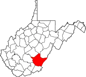
| State | West Virginia |
| County | Greenbrier |
| Elevation | 2,379 ft (725 m) |
| Time zone | UTC-5 (Eastern (EST)) |
| • Summer (DST) | UTC-4 (EDT) |
| ZIP code | 24957 |
| Area code(s) | 304 & 681 |
| GNIS feature ID | [1] |
Maxwelton is an unincorporated community in Greenbrier County, West Virginia, United States. Maxwelton is located on U.S. Route 219, 5 miles (8.0 km) north-northeast of Lewisburg. Maxwelton has a post office with ZIP code 24957.[2]
A former variant name was Hattie.[3]
The Greenbrier Valley Airport is located in Maxwelton.
References
- ↑ U.S. Geological Survey Geographic Names Information System: Maxwelton, West Virginia
- ↑ ZIP Code Lookup
- ↑ Kenny, Hamill (1945). West Virginia Place Names: Their Origin and Meaning, Including the Nomenclature of the Streams and Mountains. Piedmont, WV: The Place Name Press. pp. 406–407.
This article is issued from Wikipedia. The text is licensed under Creative Commons - Attribution - Sharealike. Additional terms may apply for the media files.