Mischendorf | |
|---|---|
 View of Mischendorf | |
 Coat of arms | |
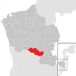 Location within Oberwart district | |
 Mischendorf Location within Austria | |
| Coordinates: 47°12′N 16°19′E / 47.200°N 16.317°E | |
| Country | Austria |
| State | Burgenland |
| District | Oberwart |
| Government | |
| • Mayor | Martin Csebits |
| Area | |
| • Total | 26.19 km2 (10.11 sq mi) |
| Elevation | 272 m (892 ft) |
| Population (2018-01-01)[2] | |
| • Total | 1,589 |
| • Density | 61/km2 (160/sq mi) |
| Time zone | UTC+1 (CET) |
| • Summer (DST) | UTC+2 (CEST) |
| Postal code | 7411 |
Mischendorf is a town in the district of Oberwart in the Austrian state of Burgenland.
Population
| Year | Pop. | ±% |
|---|---|---|
| 1869 | 1,962 | — |
| 1880 | 2,132 | +8.7% |
| 1890 | 2,365 | +10.9% |
| 1900 | 2,472 | +4.5% |
| 1910 | 2,312 | −6.5% |
| 1923 | 2,194 | −5.1% |
| 1934 | 2,220 | +1.2% |
| 1939 | 2,083 | −6.2% |
| 1951 | 1,904 | −8.6% |
| 1961 | 1,935 | +1.6% |
| 1971 | 1,984 | +2.5% |
| 1981 | 1,957 | −1.4% |
| 1991 | 2,017 | +3.1% |
| 2001 | 1,744 | −13.5% |
| 2011 | 1,705 | −2.2% |
References
- ↑ "Dauersiedlungsraum der Gemeinden Politischen Bezirke und Bundesländer - Gebietsstand 1.1.2018". Statistics Austria. Retrieved 10 March 2019.
- ↑ "Einwohnerzahl 1.1.2018 nach Gemeinden mit Status, Gebietsstand 1.1.2018". Statistics Austria. Retrieved 9 March 2019.
This article is issued from Wikipedia. The text is licensed under Creative Commons - Attribution - Sharealike. Additional terms may apply for the media files.