Montviron | |
|---|---|
Part of Sartilly-Baie-Bocage | |
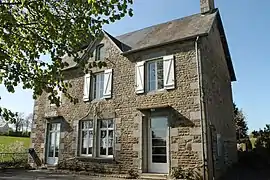 Town hall | |
Location of Montviron | |
 Montviron  Montviron | |
| Coordinates: 48°44′18″N 1°25′09″W / 48.7383°N 1.4192°W | |
| Country | France |
| Region | Normandy |
| Department | Manche |
| Arrondissement | Avranches |
| Canton | Avranches |
| Commune | Sartilly-Baie-Bocage |
| Area 1 | 5.91 km2 (2.28 sq mi) |
| Population (2019)[1] | 340 |
| • Density | 58/km2 (150/sq mi) |
| Time zone | UTC+01:00 (CET) |
| • Summer (DST) | UTC+02:00 (CEST) |
| Postal code | 50530 |
| Elevation | 27–121 m (89–397 ft) (avg. 91 m or 299 ft) |
| 1 French Land Register data, which excludes lakes, ponds, glaciers > 1 km2 (0.386 sq mi or 247 acres) and river estuaries. | |
Montviron (French pronunciation: [mɔ̃viʁɔ̃]) is a former commune in the Manche department in Normandy in north-western France. On 1 January 2016, it was merged into the new commune of Sartilly-Baie-Bocage.[2]
See also
References
- ↑ Téléchargement du fichier d'ensemble des populations légales en 2019, INSEE
- ↑ Arrêté préfectoral 14 December 2015 (in French)
Wikimedia Commons has media related to Montviron.
This article is issued from Wikipedia. The text is licensed under Creative Commons - Attribution - Sharealike. Additional terms may apply for the media files.