Morazzone | |
|---|---|
| Comune di Morazzone | |
 Coat of arms | |
Location of Morazzone | |
 Morazzone Location of Morazzone in Italy 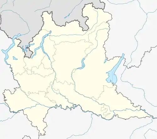 Morazzone Morazzone (Lombardy) | |
| Coordinates: 45°46′N 8°50′E / 45.767°N 8.833°E | |
| Country | Italy |
| Region | Lombardy |
| Province | Varese (VA) |
| Area | |
| • Total | 5.5 km2 (2.1 sq mi) |
| Population (Dec. 2004)[2] | |
| • Total | 4,275 |
| • Density | 780/km2 (2,000/sq mi) |
| Demonym | Morazzonesi |
| Time zone | UTC+1 (CET) |
| • Summer (DST) | UTC+2 (CEST) |
| Postal code | 21040 |
| Dialing code | 0332 |
| Patron saint | St. Ambrose |
| Saint day | 7 December |
| Website | Official website |
Morazzone is a comune (municipality) of c. 4,000 inhabitants in the province of Varese in the Italian region Lombardy, located about 40 kilometres (25 mi) northwest of Milan and about 6 kilometres (4 mi) south of Varese. It is served by Gazzada-Schianno-Morazzone railway station.
Morazzone borders the following municipalities: Brunello, Caronno Varesino, Castiglione Olona, Castronno, Gazzada Schianno, Gornate-Olona, Lozza.
 Old coat of arms
Sister towns
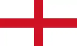 Wimblington, England, United Kingdom (2007);
 Békésszentandrás, Hungary (2016).
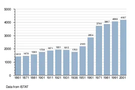
Demographic evolution
References
- ↑ "Superficie di Comuni Province e Regioni italiane al 9 ottobre 2011". Italian National Institute of Statistics. Retrieved 16 March 2019.
- ↑ All demographics and other statistics: Italian statistical institute Istat.
External links
This article is issued from Wikipedia. The text is licensed under Creative Commons - Attribution - Sharealike. Additional terms may apply for the media files.