Moshannon, Pennsylvania | |
|---|---|
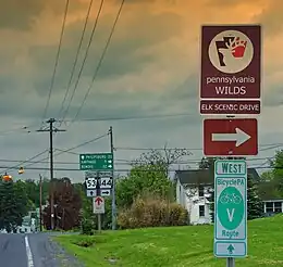 Intersection of PA Routes 144 and 53 | |
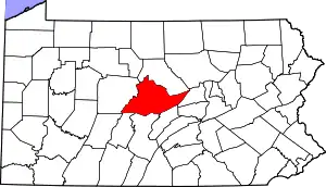 Map showing Centre County in Pennsylvania | |
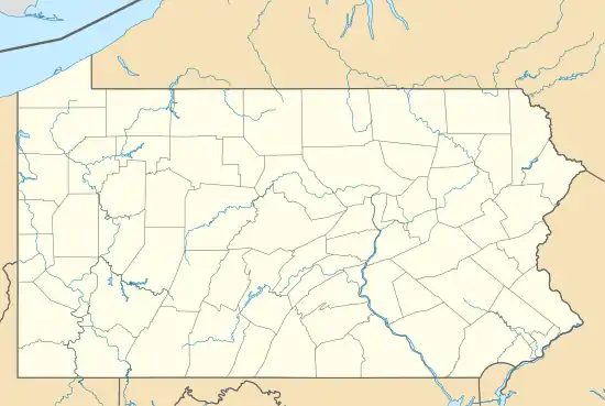 Moshannon Location in Pennsylvania | |
| Coordinates: 41°1′55″N 78°0′18″W / 41.03194°N 78.00500°W | |
| Country | United States |
| State | Pennsylvania |
| County | Centre |
| Township | Snow Shoe |
| Area | |
| • Total | 0.34 sq mi (0.87 km2) |
| • Land | 0.34 sq mi (0.87 km2) |
| • Water | 0.00 sq mi (0.00 km2) |
| Elevation | 1,531 ft (467 m) |
| Population | |
| • Total | 213 |
| • Density | 635.82/sq mi (245.49/km2) |
| Time zone | UTC−5 (Eastern (EST)) |
| • Summer (DST) | UTC−4 (EDT) |
| ZIP code | 16859 |
| FIPS code | 42-51240 |
| GNIS feature ID | 1181610 |
Moshannon is an unincorporated community and census-designated place (CDP) in Snow Shoe Township, Pennsylvania, United States. As of the 2010 census, the population was 281 residents.[3] It is located 4 miles (6 km) northwest of Interstate 80 at the convergence of Pennsylvania Routes 53 and 144. Black Moshannon Creek, part of the West Branch Susquehanna River watershed, runs through a 200-foot-deep (60 m) valley half a mile (0.8 km) south of the town.
The community takes its name from Moshannon Creek, a Native American name purported to mean "moose stream".[4]
Demographics
| Census | Pop. | Note | %± |
|---|---|---|---|
| 2020 | 213 | — | |
| U.S. Decennial Census[5] | |||
References
- ↑ "ArcGIS REST Services Directory". United States Census Bureau. Retrieved October 12, 2022.
- ↑ "Census Population API". United States Census Bureau. Retrieved October 12, 2022.
- ↑ "Geographic Identifiers: 2010 Census Summary File 1 (G001): Moshannon CDP, Pennsylvania". U.S. Census Bureau, American Factfinder. Archived from the original on April 17, 2015. Retrieved April 17, 2015.
- ↑ Espenshade, Abraham Howry (1925). Pennsylvania Place Names. Evangelical Press. p. 285. ISBN 978-0-8063-0416-8.
- ↑ "Census of Population and Housing". Census.gov. Retrieved June 4, 2016.
This article is issued from Wikipedia. The text is licensed under Creative Commons - Attribution - Sharealike. Additional terms may apply for the media files.