| Mount Joffre | |
|---|---|
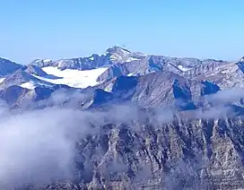 Mount Joffre in the distance | |
| Highest point | |
| Elevation | 3,450 m (11,320 ft)[1] |
| Prominence | 1,505 m (4,938 ft)[2] |
| Parent peak | Mount Assiniboine (3616 m)[2] |
| Listing | |
| Coordinates | 50°31′41″N 115°12′24″W / 50.52806°N 115.20667°W[3] |
| Geography | |
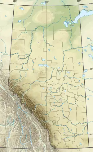 Mount Joffre Location in Alberta 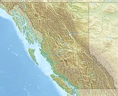 Mount Joffre Location in British Columbia | |
| Country | Canada |
| Provinces | Alberta and British Columbia |
| Parent range | Elk Range, Canadian Rockies |
| Topo map | NTS 82J11 Kananaskis Lakes[3] |
| Climbing | |
| First ascent | 1919 by Joseph Hickson, guided by Edward Feuz jr.[1] |
| Easiest route | rock/snow climb |
Mount Joffre is a mountain located on the Continental Divide, in Peter Lougheed Provincial Park, Alberta, and Elk Lakes and Height of the Rockies Provincial Parks in British Columbia.[3] The mountain was named in 1918 by the Interprovincial Boundary Survey after Marshal Joseph Joffre, commander-in-chief of the French Army during World War I.[1]
The normal climbing route (UIAA class II) is via the north face, which is covered by the Mangin Glacier.[4][5]
See also
References
- 1 2 3 "Mount Joffre". cdnrockiesdatabases.ca. Retrieved 2004-08-04.
- 1 2 "Mount Joffre". Bivouac.com. Retrieved 2009-01-02.
- 1 2 3 "Mount Joffre". BC Geographical Names. Retrieved 2021-07-16.
- ↑ Corbett, Bill (2004). The 11,000ERS of the Canadian Rockies. Rocky Mountain Books. pp. 212–213. ISBN 9781897522400.
- ↑ "Topographic map of Mount Joffre". opentopomap.org. Retrieved 2021-10-31.
Further reading
- Birrell, Dave. 50 Roadside Panoramas in the Canadian Rockies. p. 108. Retrieved 2021-07-16.
- Alan Kane, Scrambles in the Canadian Rockies – New Edition
- Aaron Cameron, Matt Gunn, Hikes Around Invermere & the Columbia River Valley, P 179
This article is issued from Wikipedia. The text is licensed under Creative Commons - Attribution - Sharealike. Additional terms may apply for the media files.