Muldestausee | |
|---|---|
Location of Muldestausee within Anhalt-Bitterfeld district 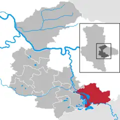 | |
 Muldestausee 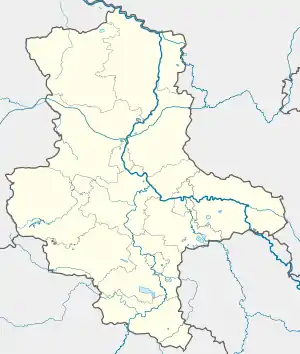 Muldestausee | |
| Coordinates: 51°39′27.5″N 12°26′12.9″E / 51.657639°N 12.436917°E | |
| Country | Germany |
| State | Saxony-Anhalt |
| District | Anhalt-Bitterfeld |
| Government | |
| • Mayor (2016–23) | Ferid Giebler[1] |
| Area | |
| • Total | 136.82 km2 (52.83 sq mi) |
| Population (2021-12-31)[2] | |
| • Total | 11,557 |
| • Density | 84/km2 (220/sq mi) |
| Time zone | UTC+01:00 (CET) |
| • Summer (DST) | UTC+02:00 (CEST) |
| Postal codes | 06774 |
| Dialling codes | 03493, 034955 |
| Vehicle registration | ABI |
| Website | www |
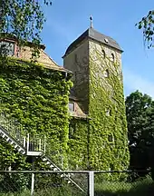
Castle in Pouch
Muldestausee is a municipality in the district of Anhalt-Bitterfeld, in Saxony-Anhalt, Germany. It was formed on 1 January 2010 by the merger of the former municipalities Burgkemnitz, Friedersdorf, Gossa, Gröbern, Krina, Mühlbeck, Muldenstein, Plodda, Pouch, Rösa, Schlaitz and Schwemsal.[3]
The municipality consists of the Ortschaften or municipal divisions Burgkemnitz, Friedersdorf, Gossa, Gröbern, Krina, Mühlbeck, Muldenstein, Plodda, Pouch, Rösa, Schlaitz, Schmerz and Schwemsal. Its seat is in the village Pouch.[4]
References
- ↑ Bürgermeisterwahlen in den Gemeinden, Endgültige Ergebnisse, Statistisches Landesamt Sachsen-Anhalt, accessed 8 July 2021.
- ↑ "Bevölkerung der Gemeinden – Stand: 31. Dezember 2021" (PDF) (in German). Statistisches Landesamt Sachsen-Anhalt. June 2022.
- ↑ Gebietsänderungen vom 01. Januar bis 31. Dezember 2010, Statistisches Bundesamt
- ↑ Hauptsatzung der Gemeinde Muldestausee, 3 July 2019.
Towns and municipalities in the district of Anhalt-Bitterfeld | ||
|---|---|---|
Coat of arms | ||
This article is issued from Wikipedia. The text is licensed under Creative Commons - Attribution - Sharealike. Additional terms may apply for the media files.