Nadupuru | |
|---|---|
Neighbourhood | |
 AMTZ Building | |
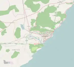 Nadupuru Location in Visakhapatnam | |
| Coordinates: 17°40′15″N 83°11′44″E / 17.670779°N 83.195647°E | |
| Country | |
| State | Andhra Pradesh |
| District | Visakhapatnam |
| Government | |
| • Body | Greater Visakhapatnam Municipal Corporation |
| Languages | |
| • Official | Telugu |
| Time zone | UTC+5:30 (IST) |
| PIN | 530044 |
| Vehicle registration | AP-31 |
Nadupuru is a residential area of the city of Visakhapatnam state of Andhra Pradesh, India.[1]
Transport
- APSRTC routes
| Route Number | Start | End | Via |
|---|---|---|---|
| 38D | Nadupuru Dairy Colony | RTC Complex | Pedagantyada, New Gajuwaka, Old Gajuwaka, BHPV, Airport, NAD Junction, Birla Junction, Gurudwar |
References
- ↑ "Nadupuru Locality Map, Visakhapatnam". www.indiamapia.com.
This article is issued from Wikipedia. The text is licensed under Creative Commons - Attribution - Sharealike. Additional terms may apply for the media files.