| Neetze | |
|---|---|
 | |
| Location | |
| Country | Germany |
| State | Lower Saxony |
| Physical characteristics | |
| Source | |
| • location | Göhrde State Forest |
| • coordinates | 53°09′58″N 10°47′27″E / 53.1661°N 10.7909°E |
| • elevation | 48 m above sea level (NN) |
| Mouth | |
• location | near Winsen (Luhe) into the Ilmenau |
• coordinates | 53°21′40″N 10°18′23″E / 53.3610°N 10.3063°E |
• elevation | 2 m above sea level (NN) |
| Length | 41.8 km (26.0 mi) [1] |
| Basin size | 244 km2 (94 sq mi) [1] |
| Basin features | |
| Progression | Ilmenau→ Elbe→ North Sea |
| Landmarks |
|
| Tributaries | |
| • left | Kalberlah, Mausetalbach, Sankt Vitusbach, Strangengraben |
| • right | Harmsdorfer Bach, Bruchwetter, Marschwetter |
| Waterbodies | Lakes: Reihersee, Barumer See |
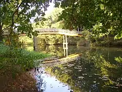
Neetze is a river of Lower Saxony, Germany. It is a left tributary of the Ilmenau. It has a length of approximately 42 km (26 mi) and possesses several side arms.
See also
References
This article is issued from Wikipedia. The text is licensed under Creative Commons - Attribution - Sharealike. Additional terms may apply for the media files.