Nesna | |
|---|---|
Village | |
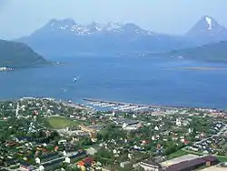 View of the village | |
 Nesna Location of the village  Nesna Nesna (Norway) | |
| Coordinates: 66°11′54″N 13°01′06″E / 66.1982°N 13.0184°E | |
| Country | Norway |
| Region | Northern Norway |
| County | Nordland |
| District | Helgeland |
| Municipality | Nesna Municipality |
| Area | |
| • Total | 1.12 km2 (0.43 sq mi) |
| Elevation | 10 m (30 ft) |
| Population (2018)[1] | |
| • Total | 1,340 |
| • Density | 1,196/km2 (3,100/sq mi) |
| Time zone | UTC+01:00 (CET) |
| • Summer (DST) | UTC+02:00 (CEST) |
| Post Code | 8700 Nesna |
Nesna is the administrative centre of Nesna Municipality in Nordland county, Norway. The village is located on a peninsula on the mainland of Norway, along the Nesnakroken strait, just north of the Ranfjorden and south of the Sjona fjord. The Norwegian County Road 17 crosses the Ranfjorden on a ferry which docks in the village before heading north along the coastline. Nesna has regular ferry connections to the nearby islands of Handnesøya, Hugla, and Tomma.[3]
The 1.12-square-kilometre (280-acre) village has a population (2018) of 1,340 and a population density of 1,196 inhabitants per square kilometre (3,100/sq mi).[1]
Nesna Church is located in the village, and the village is also host to a campus of Nord University.[3]
Media gallery
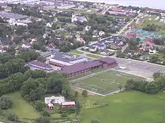
 The village in the lower right corner.
 Aerial view looking northwest
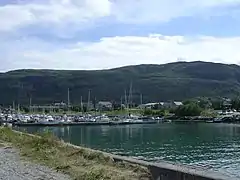 Harbour view
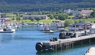 Harbour view
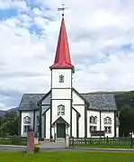
References
- 1 2 3 Statistisk sentralbyrå (1 January 2018). "Urban settlements. Population and area, by municipality".
- ↑ "Nesna (Nordland)". yr.no. Retrieved 2019-02-17.
- 1 2 Thorsnæs, Geir, ed. (2016-03-25). "Nesna – tettsted". Store norske leksikon (in Norwegian). Kunnskapsforlaget. Retrieved 2019-02-03.
This article is issued from Wikipedia. The text is licensed under Creative Commons - Attribution - Sharealike. Additional terms may apply for the media files.