Ngân Sơn district
Huyện Ngân Sơn | |
|---|---|
 Nà Phặc town centre | |
| Country | |
| Province | Bắc Kạn |
| Capital | Vân Tùng |
| Area | |
| • Land | 248.8 sq mi (644.4 km2) |
| Population (2003) | |
| • Total | 29,509 |
| Time zone | UTC+07:00 (Indochina Time) |
Ngân Sơn is a rural district of Bắc Kạn province in the Northeast region of Vietnam. As of 2003, the district had a population of 29,509 people.[1] The district covers an area of 644.4 km². The district capital lies at Vân Tùng commune.[1]
Administrative divisions
The district is subdivided to 11 commune level subdivisions, including the township of Nà Phặc, and the rural communes of: Hương Nê, Lãng Ngâm, Thuần Mang, Thượng Quan, Đức Vân, Vân Tùng (district capital), Trung Hòa, Cốc Đán, Thượng Ân and Bằng Vân.
Climate
| Climate data for Ngân Sơn | |||||||||||||
|---|---|---|---|---|---|---|---|---|---|---|---|---|---|
| Month | Jan | Feb | Mar | Apr | May | Jun | Jul | Aug | Sep | Oct | Nov | Dec | Year |
| Record high °C (°F) | 28.5 (83.3) |
33.1 (91.6) |
34.3 (93.7) |
36.0 (96.8) |
36.9 (98.4) |
35.9 (96.6) |
35.4 (95.7) |
35.8 (96.4) |
34.9 (94.8) |
32.5 (90.5) |
31.6 (88.9) |
30.1 (86.2) |
36.9 (98.4) |
| Mean daily maximum °C (°F) | 16.5 (61.7) |
18.0 (64.4) |
21.2 (70.2) |
25.5 (77.9) |
28.7 (83.7) |
29.9 (85.8) |
30.2 (86.4) |
30.3 (86.5) |
29.1 (84.4) |
26.2 (79.2) |
22.6 (72.7) |
18.9 (66.0) |
24.8 (76.6) |
| Daily mean °C (°F) | 12.5 (54.5) |
14.2 (57.6) |
17.4 (63.3) |
21.4 (70.5) |
24.2 (75.6) |
25.6 (78.1) |
25.7 (78.3) |
25.4 (77.7) |
24.0 (75.2) |
21.2 (70.2) |
17.4 (63.3) |
13.7 (56.7) |
20.2 (68.4) |
| Mean daily minimum °C (°F) | 9.8 (49.6) |
11.7 (53.1) |
14.9 (58.8) |
18.6 (65.5) |
21.1 (70.0) |
22.7 (72.9) |
22.9 (73.2) |
22.3 (72.1) |
20.8 (69.4) |
17.9 (64.2) |
14.0 (57.2) |
10.3 (50.5) |
17.2 (63.0) |
| Record low °C (°F) | −2.0 (28.4) |
0.2 (32.4) |
2.8 (37.0) |
7.7 (45.9) |
12.3 (54.1) |
14.0 (57.2) |
15.0 (59.0) |
15.8 (60.4) |
13.2 (55.8) |
5.9 (42.6) |
1.8 (35.2) |
−1.7 (28.9) |
−2.0 (28.4) |
| Average precipitation mm (inches) | 32.4 (1.28) |
30.4 (1.20) |
58.8 (2.31) |
102.0 (4.02) |
219.7 (8.65) |
273.4 (10.76) |
332.0 (13.07) |
291.7 (11.48) |
161.3 (6.35) |
92.5 (3.64) |
55.2 (2.17) |
27.9 (1.10) |
1,677.4 (66.04) |
| Average rainy days | 11.1 | 11.7 | 14.3 | 14.2 | 15.3 | 18.4 | 20.7 | 19.1 | 13.5 | 10.2 | 8.4 | 7.5 | 164.3 |
| Average relative humidity (%) | 82.0 | 82.9 | 83.4 | 83.0 | 81.6 | 83.5 | 85.4 | 85.3 | 83.0 | 81.4 | 81.1 | 80.1 | 82.7 |
| Mean monthly sunshine hours | 62.5 | 66.8 | 58.2 | 96.4 | 149.9 | 132.0 | 144.7 | 174.2 | 157.1 | 127.9 | 116.5 | 103.0 | 1,389.2 |
| Source: Vietnam Institute for Building Science and Technology[2] | |||||||||||||
References
- 1 2 "Districts of Vietnam". Statoids. Retrieved March 13, 2009.
- ↑ "Vietnam Institute for Building Science and Technology" (PDF). Retrieved 16 August 2023.
| Bắc Giang province | 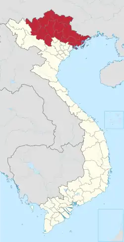 | |
|---|---|---|
| Bắc Kạn province | ||
| Cao Bằng province | ||
| Hà Giang province | ||
| Lạng Sơn province | ||
| Phú Thọ province | ||
| Quảng Ninh province |
| |
| Thái Nguyên province | ||
| Tuyên Quang province | ||
※ denotes provincial seat. | ||
This article is issued from Wikipedia. The text is licensed under Creative Commons - Attribution - Sharealike. Additional terms may apply for the media files.