North Montpelier, Vermont | |
|---|---|
Village | |
 North Montpelier | |
| Coordinates: 44°18′13″N 72°26′47″W / 44.30361°N 72.44639°W | |
| Country | United States |
| State | Vermont |
| County | Washington |
| Elevation | 709 ft (216 m) |
| Time zone | UTC-5 (Eastern (EST)) |
| • Summer (DST) | UTC-4 (EDT) |
| ZIP code | 05666[1] |
| Area code | 802 |
| GNIS feature ID | 1458748[2] |
North Montpelier is an unincorporated village in the town of East Montpelier, Washington County, Vermont, United States. The community is located at the junction of Vermont routes 14 and 214, 7 miles (11 km) east-northeast of Montpelier.
References
- ↑ United States Postal Service. "USPS - Look Up a ZIP Code". Retrieved May 20, 2017.
- ↑ "North Montpelier". Geographic Names Information System. United States Geological Survey, United States Department of the Interior.
Municipalities and communities of Washington County, Vermont, United States | ||
|---|---|---|
| Cities | 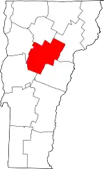 Map of Vermont highlighting Washington County | |
| Towns | ||
| Village | ||
| CDPs | ||
| Other communities | ||
This article is issued from Wikipedia. The text is licensed under Creative Commons - Attribution - Sharealike. Additional terms may apply for the media files.