Norwood, Georgia | |
|---|---|
 Location in Warren County and the state of Georgia | |
| Coordinates: 33°27′50″N 82°42′21″W / 33.46389°N 82.70583°W | |
| Country | United States |
| State | Georgia |
| County | Warren |
| Area | |
| • Total | 0.82 sq mi (2.14 km2) |
| • Land | 0.81 sq mi (2.11 km2) |
| • Water | 0.01 sq mi (0.03 km2) |
| Elevation | 614 ft (187 m) |
| Population (2020) | |
| • Total | 202 |
| • Density | 248.16/sq mi (95.77/km2) |
| Time zone | UTC-5 (Eastern (EST)) |
| • Summer (DST) | UTC-4 (EDT) |
| ZIP code | 30821 |
| Area code | 706 |
| FIPS code | 13-56560[2] |
| GNIS feature ID | 0319712[3] |
Norwood is a city in Warren County, Georgia, United States. The population was 202 in 2020.
History
The Georgia General Assembly incorporated Norwood as a town in 1885.[4] The community most likely was named after a local family.[5]
Geography
Norwood is located at 33°27′50″N 82°42′21″W / 33.46389°N 82.70583°W (33.463962, -82.705700).[6]
According to the United States Census Bureau, the city has a total area of 0.8 square miles (2.1 km2), all land.
Major Highways
 Interstate 20
 U.S. Route 278
 State Route 12
 State Route 402 (unsigned designation for I-20)
Demographics
| Census | Pop. | Note | %± |
|---|---|---|---|
| 1890 | 332 | — | |
| 1900 | 299 | −9.9% | |
| 1910 | 340 | 13.7% | |
| 1920 | 366 | 7.6% | |
| 1930 | 401 | 9.6% | |
| 1940 | 269 | −32.9% | |
| 1950 | 268 | −0.4% | |
| 1960 | 294 | 9.7% | |
| 1970 | 272 | −7.5% | |
| 1980 | 306 | 12.5% | |
| 1990 | 238 | −22.2% | |
| 2000 | 299 | 25.6% | |
| 2010 | 239 | −20.1% | |
| 2020 | 202 | −15.5% | |
| U.S. Decennial Census[7] | |||
At the 2000 census there were 299 people, 126 households, and 82 families living in the city. By 2020, its population was 202.
See also
References
- ↑ "2020 U.S. Gazetteer Files". United States Census Bureau. Retrieved December 18, 2021.
- ↑ "U.S. Census website". United States Census Bureau. Retrieved January 31, 2008.
- ↑ "US Board on Geographic Names". United States Geological Survey. October 25, 2007. Retrieved January 31, 2008.
- ↑ Acts Passed by the General Assembly of Georgia. J. Johnston. 1885. p. 394.
- ↑ Krakow, Kenneth K. (1975). Georgia Place-Names: Their History and Origins (PDF). Macon, GA: Winship Press. p. 161. ISBN 0-915430-00-2.
- ↑ "US Gazetteer files: 2010, 2000, and 1990". United States Census Bureau. February 12, 2011. Retrieved April 23, 2011.
- ↑ "Census of Population and Housing". Census.gov. Retrieved June 4, 2015.
Municipalities and communities of Warren County, Georgia, United States | ||
|---|---|---|
| Cities | 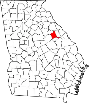 Map of Georgia highlighting Warren County | |
| Town | ||
| Unincorporated communities | ||
This article is issued from Wikipedia. The text is licensed under Creative Commons - Attribution - Sharealike. Additional terms may apply for the media files.