Nyaung-U
ညောင်ဦးမြို့ | |
|---|---|
Town | |
 | |
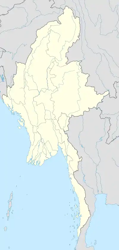 Nyaung-U Location in Burma | |
| Coordinates: 21°12′N 94°55′E / 21.200°N 94.917°E | |
| Country | |
| Division | |
| District | Nyaung-U District |
| Township | Nyaung-U Township |
| Population (2014) | 48,528 |
| • Religions | Buddhism |
| Time zone | UTC+6.30 (MST) |
Nyaung-U (Burmese: ညောင်ဦးမြို့) is the administrative town of Nyaung-U Township of Nyaung-U District in the Mandalay Region of central Myanmar. It lies on the eastern bank of Ayeyarwady River. It is just 4 kilometers away from old Bagan, a popular tourist attraction.[1] The Shwezigon Pagoda is located there. The other popular places in and around Nyaung-U were [2]
- Htilominlo Pagoda
- Gubyaukgyi Pagoda
- Ahlodawpyae Pagoda and
- Hgnet Pyit Taung Hill
It is the home of Nyaung U Airport. It can be reached by air, by railway, by bus[3] and by boat.[4]
The 8.10 inches (203 mm) rainfall of 19 Oct 2011 was the record breaking one for past 47 years. The previous record was 5.67 inches (144 mm) of 9 Oct 1989.[5] It has a population of 48,528.[6]
Climate
| Climate data for Nyaung-U (1991–2020) | |||||||||||||
|---|---|---|---|---|---|---|---|---|---|---|---|---|---|
| Month | Jan | Feb | Mar | Apr | May | Jun | Jul | Aug | Sep | Oct | Nov | Dec | Year |
| Mean daily maximum °C (°F) | 29.8 (85.6) |
33.2 (91.8) |
37.2 (99.0) |
39.7 (103.5) |
38.0 (100.4) |
35.4 (95.7) |
35.2 (95.4) |
34.2 (93.6) |
33.6 (92.5) |
32.9 (91.2) |
31.8 (89.2) |
29.5 (85.1) |
34.2 (93.6) |
| Daily mean °C (°F) | 21.5 (70.7) |
24.2 (75.6) |
28.5 (83.3) |
32.1 (89.8) |
32.2 (90.0) |
30.9 (87.6) |
30.8 (87.4) |
30.1 (86.2) |
29.5 (85.1) |
28.4 (83.1) |
25.8 (78.4) |
22.3 (72.1) |
28.0 (82.4) |
| Mean daily minimum °C (°F) | 13.3 (55.9) |
15.2 (59.4) |
19.9 (67.8) |
24.5 (76.1) |
26.3 (79.3) |
26.4 (79.5) |
26.5 (79.7) |
26.0 (78.8) |
25.4 (77.7) |
24.0 (75.2) |
19.8 (67.6) |
15.2 (59.4) |
21.9 (71.4) |
| Average precipitation mm (inches) | 4.4 (0.17) |
1.7 (0.07) |
4.8 (0.19) |
11.6 (0.46) |
106.2 (4.18) |
68.4 (2.69) |
38.6 (1.52) |
96.7 (3.81) |
143.5 (5.65) |
129.3 (5.09) |
25.9 (1.02) |
4.3 (0.17) |
635.5 (25.02) |
| Average precipitation days (≥ 1.0 mm) | 0.5 | 0.3 | 0.5 | 1.6 | 6.4 | 6.6 | 5.1 | 8.9 | 10.2 | 7.9 | 2.4 | 1.0 | 51.5 |
| Source: World Meteorological Organization[7] | |||||||||||||
References
- ↑ "Nyaung U village Bagan". Archived from the original on 2013-03-26. Retrieved 2011-10-21.
- ↑ "Places to Visit in Bagan". Archived from the original on 2011-10-12. Retrieved 2011-10-21.
- ↑ "Temple overload - Nyaung U (Bagan), Myanmar Travel Blog". Archived from the original on 2011-10-28. Retrieved 2011-10-21.
- ↑ "The Slow Boat to Nyaung U - Adam Cohn - the School of Thought".
- ↑ http://www.mrtv3.net.mm/newpaper/2110newsm.pdf%5B%5D Page 19 Col 2
- ↑ "Myanmar: Regions, States, Major Cities & Towns - Population Statistics, Maps, Charts, Weather and Web Information". www.citypopulation.de. Retrieved 2021-04-01.
- ↑ "World Meteorological Organization Climate Normals for 1991–2020". World Meteorological Organization. Retrieved 16 October 2023.
External links
Wikimedia Commons has media related to Nyaung U.
- Satellite map at Maplandia.com
- http://m.naim.my/the-market-at-nyaung-u/
- http://www.exoticmyanmartravel.com/nyaung_u.htm%5B%5D
Capital: Mandalay | ||
| Kyaukse District |  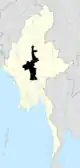 | |
| Mandalay District | ||
| Meiktila District | ||
| Myingyan District | ||
| Nyaung-U District | ||
| Pyinoolwin District | ||
| Yamethin District | ||
| Main cities and towns | ||
This article is issued from Wikipedia. The text is licensed under Creative Commons - Attribution - Sharealike. Additional terms may apply for the media files.