Oakdale No. 320 | |
|---|---|
| Rural Municipality of Oakdale No. 320 | |
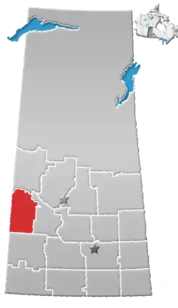
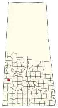 Location of the RM of Oakdale No. 320 in Saskatchewan | |
| Coordinates: 51°42′25″N 109°10′55″W / 51.707°N 109.182°W[1] | |
| Country | Canada |
| Province | Saskatchewan |
| Census division | 13 |
| SARM division | 6 |
| Formed[2] | December 13, 1909 |
| Government | |
| • Reeve | Darwin Whitfield |
| • Governing body | RM of Oakdale No. 320 Council |
| • Administrator | Gillain Lund |
| • Office location | Coleville |
| Area (2016)[4] | |
| • Land | 805.92 km2 (311.17 sq mi) |
| Population (2016)[4] | |
| • Total | 253 |
| • Density | 0.3/km2 (0.8/sq mi) |
| Time zone | CST |
| • Summer (DST) | CST |
| Area code(s) | 306 and 639 |
The Rural Municipality of Oakdale No. 320 (2016 population: 253) is a rural municipality (RM) in the Canadian province of Saskatchewan within Census Division No. 13 and SARM Division No. 6. Located in the west-central portion of the province, it is near the Alberta boundary.
History
The RM of Oakdale No. 320 incorporated as a rural municipality on December 13, 1909.[2]
Geography
Communities and localities
The following urban municipalities are surrounded by the RM.
The following unincorporated communities are within the RM.
- Localities
- Beaufield (Ednaburg)
- Driver
Demographics
In the 2021 Census of Population conducted by Statistics Canada, the RM of Oakdale No. 320 had a population of 216 living in 95 of its 118 total private dwellings, a change of -14.6% from its 2016 population of 253. With a land area of 826.79 km2 (319.23 sq mi), it had a population density of 0.3/km2 (0.7/sq mi) in 2021.[7]
In the 2016 Census of Population, the RM of Oakdale No. 320 recorded a population of 253 living in 97 of its 114 total private dwellings, a -1.9% change from its 2011 population of 258. With a land area of 805.92 km2 (311.17 sq mi), it had a population density of 0.3/km2 (0.8/sq mi) in 2016.[4]
Government
The RM of Oakdale No. 320 is governed by an elected municipal council and an appointed administrator that meets on the second Monday of every month.[3] The reeve of the RM is Darwin Whitfield while its administrator is Gillain Lund.[3] The RM's office is located in Coleville.[3]
Education
- Current school divisions
- Sun West School Division No. 207 — As of 2006, the Kindersley School Division and 5 other divisions were amalgamated into the Sun West School Division.
- Former amalgamated school divisions
- Kindersley Schoold Division No. 34 (1947–2006)
- Former 'single-room schoolhouse' school districts
- Algoma School District No. 2876 (1914–1946)
- Ashford School District No. 3773 (1916–1947)
- Avoca School District No. 3363 (1914–1947)
- Beaufield School District No. 3169 (1913–1947)
- Bonn School District No. 2475 (1909–1947)
- Buffalo Coulee School District No. 4278 (1919–1947)
- Coleville School District No. 3645 (1915–1946)
- Driver School District No. 811 (1912–1947)
- Elm Point School District No. 2779 (1911–1947)
- Eureka School District No. 2174 (1908–1947)
- Gleneath School District No. 4453 (1921–1947)
- Hopedale School District No. 346 (1911–1947)
- McKellar School District No. 584 (1910–1947)
- St. Florence School District No. 4299 (1920–1947)
- Somme School District No. 4127 (19??-1947)
- Teo Lake School District No. 1358 (1912–1947)
- Warwick School District No. 3080 (1913–1940)
Transportation
- Rail[8]
- C.N.R. Dodsland Branch — served Beaufield, Coleville, and Driver
- C.N.R. Outlook-Kerrobert Branch — served Ermine
- Roads
- Highway 21
- Highway 307 — serves Coleville
References
- ↑ "Pre-packaged CSV files - CGN, Canada/Province/Territory (cgn_sk_csv_eng.zip)". Government of Canada. July 24, 2019. Retrieved May 23, 2020.
- 1 2 "Rural Municipality Incorporations (Alphabetical)". Saskatchewan Ministry of Municipal Affairs. Archived from the original on April 21, 2011. Retrieved May 9, 2020.
- 1 2 3 4 "Municipality Details: RM of Oakdale No. 320". Government of Saskatchewan. Retrieved May 21, 2020.
- 1 2 3 "Population and dwelling counts, for Canada, provinces and territories, and census subdivisions (municipalities), 2016 and 2011 censuses – 100% data (Saskatchewan)". Statistics Canada. February 8, 2017. Retrieved May 1, 2020.
- ↑ "Saskatchewan Census Population" (PDF). Saskatchewan Bureau of Statistics. Archived from the original (PDF) on September 24, 2015. Retrieved May 9, 2020.
- ↑ "Saskatchewan Census Population". Saskatchewan Bureau of Statistics. Retrieved May 9, 2020.
- ↑ "Population and dwelling counts: Canada, provinces and territories, census divisions and census subdivisions (municipalities), Saskatchewan". Statistics Canada. February 9, 2022. Retrieved April 13, 2022.
- ↑ Waghorn's Guide, 1925