Ocampo | |
|---|---|
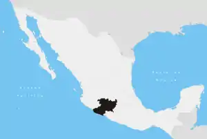
 Ocampo Location in Mexico | |
| Coordinates: 19°35′04″N 100°20′32″W / 19.58444°N 100.34222°W | |
| Country | |
| State | Michoacán |
| Municipal seat | Ocampo |
| Area | |
| • Total | 146.883 km2 (56.712 sq mi) |
| Population (2010)[1] | |
| • Total | 22,628 |
| • Density | 150/km2 (400/sq mi) |
Ocampo is one of the 113 municipalities of Michoacán, in central Mexico. The municipal seat lies at Ocampo.
Geography
Towns and villages
The municipality has 42 localities. The largest are:
| Name | Population (2010) |
|---|---|
| Ocampo | 3,799 |
| Manzana de San Luis | 2,996 |
| Ejido el Rosario | 1,080 |
| Manzana la Confradía | 1,040 |
| Cuartel la Mesa (El Asoleadero) | 1,034 |
| Manzana Rancho Escondido | 911 |
| Manzana del Centro de San Cristóbal | 801 |
| Total Municipality | 22,698 |
References
- ↑ Instituto Nacional de Estadística y Geografía (2010). "Principales resultados por localidad 2010 (ITER)".
This article is issued from Wikipedia. The text is licensed under Creative Commons - Attribution - Sharealike. Additional terms may apply for the media files.