Ogooué-Lolo | |
|---|---|
 Flag  Coat of arms | |
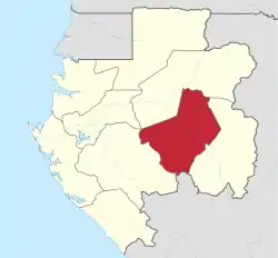 Ogooué-Lolo Province in Gabon | |
| Coordinates: 1°0′S 12°30′E / 1.000°S 12.500°E | |
| Country | |
| Capital | Koulamoutou |
| Area | |
| • Total | 25,380 km2 (9,800 sq mi) |
| Population (2013 census) | |
| • Total | 65,771 |
| • Density | 2.6/km2 (6.7/sq mi) |
| HDI (2017) | 0.633[1] medium |
The Ogooué-Lolo Province is one of the nine provinces of Gabon, slightly southeast of central Gabon. The regional capital is Koulamoutou, a city of approximately 16,000 people. It is the ninth largest city in Gabon and the home of slightly more than one-third of the provincial population.
- Area: 25,380 km²
- 2-letter abbreviation/HASC: GA-OL
- ISO 3166-2: GA-07
- Population (2013): 65,771
Its length runs from the 3 S to 2 N and from 10 E to 11 E.
To the south, Ogooué-Lolo borders the Niari Region of the Republic of the Congo. Domestically, it borders the following provinces:
- Ngounié – west-southwest
- Moyen-Ogooué – northwest, at a quadripoint
- Ogooué-Ivindo – north and northwest
- Haut-Ogooué – east
Departments
Ogooué-Lolo is divided into 4 departments:[2]
Historical population
| Year | Population | Change | Density |
|---|---|---|---|
| 1980 | 49,915 | – | 1.966/km² |
| 1993 | 43,915 | −6,000/−12.02% | 1.73/km² |
The population from 1981 to 1991 lost slightly more than one tenth of the total 1981 population. The population loss was slower than other provinces in Gabon.
Places
| Place | Latitude | Longitude | Altitude |
|---|---|---|---|
| Abena | 1.1 S | 13.1667 E | 275 m |
| Angonde | 1.0833 S | 13.11667 E | 274 m |
| Babaousa | 0.8667 S | 12.833 E | 229 m |
| Badiabiki | 1.6833 S | 12.2833 E | 698 m |
| Badouma | 0.75 S | 12.85 E | 240 m |
| Bambecan | 0.9667 S | 12.7833 E | 307 m |
| Bambera-Biyoko | 1.11667 S | 12.933 E | 312 m |
| Bandangala | 1.33 S | 12.5667 E | 551 m |
| Bangadi | 1.1667 S | 12.9833 E | 318 m |
| Bangassou | 0.95 S | 12.65 E | 262 m |
| Bangondo | 1.4 S | 12.45 E | 478 m |
| Baniati | 1.01667 S | 12.21667 E | 445 m |
| Baposso | 0.6833 S | 13.033 E | 334 m |
| Bapouno | 0.95 S | 12.6 E | 258 m |
| Bassaki | 1.31667 S | 12.11667 E | 593 m |
| Bassegua | 0.833 S | 12.8 E | 204 m |
| Bola Pessou | 1.15 S | 12.4833 E | 364 m |
| Boudela | 1.033 S | 12.01667 E | 600 m |
| Boudouga | 1.1833 S | 12.15 E | 533 m |
| Boudoumbou | 0.81667 S | 12.7833 E | 202 m |
| Boudzoumba | 0.71667 S | 13.01667 E | 303 m |
| Boueka | 1.3833 S | 12.6333 E | 507 m |
| Boulemba | 1.0833 S | 13.133 E | 274 m |
| Boumabango | 0.95 S | 12.95 E | 259 m |
| Boundgi | 1 S | 11.85 E | 550 m |
| Boundji | 0 S | 12 E | 195 m |
| Boundji | 1.4 S | 12.3833 E | 603 m |
| Boungou | 1.81667 S | 12.51667 E | 803 m |
| Bounzoukou | 1.1 S | 12.91667 E | 313 m |
| Boupounza | 1.2667 S | 11.9833 E | 664 m |
| Boussa | 0.55 S | 12.41667 E | 190 m |
| Boussimbi | 1.533 S | 12.1833 E | 670 m |
| Boussoka | 1.1833 S | 12.5833 E | 449 m |
| Boussouniabamba | 1.233 S | 12.61667 E | 466 m |
| Boutala | 0 S | 12 E | 211 m |
| Boutemba | 0.7667 S | 12.533 E | 196 m |
| Bouvinga | 1.033 S | 12.2 E | 449 |
| Bouyangoula | 1.4 S | 12.21667 E | 621 m |
| Kokomingheli | 0.71667 S | 12.933 E | 252 m |
| Konanadembe | 1 S | 12 E | 453 m |
| Konanadembe | 1.35 S | 12.6833 E | 475 m |
| Konda | 1 S | 12 E | 426 m |
| Konda | 1.31667 S | 12.6833 E | 461 m |
| Kondakoko | 1.6 S | 12.2833 E | 682 m |
| Kongo-Godafala | 0.91667 S | 12.633 E | 236 m |
| Kongou | 1 S | 12 E | 608 m |
| Kouadembe | 1 S | 12.1833 E | 453 m |
| Kouanou | 1.3 S | 12.2833 E | 588 m |
| Koubala | 1.3667 S | 12.233 E | 615 m |
| Koulamoutou | 1.133 S | 12.4833 E | 355 m |
| Koumamala | 1 S | 12 E | 613 m |
| Koumou | 1.633 S | 12.733 E | 609 m |
| Kounadembe | 1.433 S | 12.3833 E | 607 m |
| Kouta | 1.22 S | 12.25 E | 606 m |
| Mogabo | 457 m | ||
| Mogombofala |
References
- ↑ "Sub-national HDI - Area Database - Global Data Lab". hdi.globaldatalab.org. Retrieved 2018-09-13.
- ↑ "Gabon: administrative units, extended". geohive.com.
This article is issued from Wikipedia. The text is licensed under Creative Commons - Attribution - Sharealike. Additional terms may apply for the media files.