| Omuk-Kyuyol | |
|---|---|
| Омук-Кюёль / Омук-күөлэ | |
_-_May_28th%252C_2020_-_49945336776.jpg.webp) Omuk-Kyuyol Sentinel-2 image | |
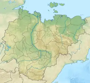 Omuk-Kyuyol Location in the Sakha Republic, Russian Far East | |
| Location | Kolyma Lowland |
| Coordinates | 68°40′N 152°08′E / 68.667°N 152.133°E |
| Primary outflows | Omuk-Kyuyol-Seen |
| Catchment area | 258 square kilometres (100 sq mi) |
| Basin countries | Russia |
| Max. length | 11 km (6.8 mi) |
| Max. width | 9 km (5.6 mi) |
| Surface area | 53.5 square kilometres (20.7 sq mi) |
| Frozen | October to June |
| Islands | None |
Omuk-Kyuyol or "Omuk-Kyuyel" (Russian: Омук-Кюёль or Омук-Кюель; Yakut: Омук-күөлэ, Omuk-küöle) is a freshwater lake in the Sakha Republic (Yakutia), Russia.[1]
The nearest inhabited place is Andryushkino, Lower Kolyma District, located about 100 km (62 mi) to the northeast.[2]
Geography
Omuk-Kyuyol lies north of the Arctic circle, in the southwestern part of the Kolyma Lowland. It is located in a large area of lakes between the basin of the Indigirka to the west and the Alazeya to the east. The main outflowing river is the Omuk-Kyuyol-Seen (Омук-Кюёль-Сээн), a small tributary of the 129 km (80 mi) long Bulgunnakhtaakh-Seene of the Alazeya basin.[1][2][3]
See also
References
- 1 2 "Озеро Омук-Кюёль in the State Water Register of Russia". textual.ru (in Russian).
- 1 2 "R-55_56 Topographic Chart (in Russian)". Retrieved 6 June 2022.
- ↑
External links
 Media related to Omuk-Kyuyol at Wikimedia Commons
- Fishing & Tourism in Yakutia
This article is issued from Wikipedia. The text is licensed under Creative Commons - Attribution - Sharealike. Additional terms may apply for the media files.