Otteri | |
|---|---|
Neighbourhood | |
 Otteri  Otteri  Otteri | |
| Coordinates: 13°05′53″N 80°15′04″E / 13.098038°N 80.251197°E | |
| Country | |
| State | |
| District | Chennai |
| Metro | Chennai |
| Elevation | 5 m (16 ft) |
| Languages | |
| • Official | Tamil |
| Time zone | UTC+5:30 (IST) |
| PIN | 600012 |
| Telephone code | 044 |
| Planning agency | CMDA |
| City | Chennai |
| Civic agency | Chennai Corporation |
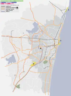
Otteri is a developed residential area in Central Chennai, a metropolitan city in Tamil Nadu, India. Otteri is a part of Purasaiwakkam but is too distinct to be called hence locals simply refer it as Otteri.
Police station
- There is a police station on Cooks road in Otteri, viz., 'Otteri Police station'.
Location
Otteri is located between Perambur and Ayanavaram and is a part of Purasaiwalkam.
Roads
- Cooks road
- Ayanavaram road
- Strahans road
- Brick kiln road
- Perambur Barracks road
- Purasawalkam High road
- DeMellows road
- Perambur High road
- Pulianthope High road.
Surroundings
- Purasawalkam
- Perambur
- Ayanavaram
- Kellys
- Kilpauk
- Egmore
- Vepery
- Doveton
- Pulianthope
- Pattalam, Chennai
- Basin Bridge
- Vyasarpadi
- Choolai
Directions From Otteri | |
|---|---|
| City |  | |
|---|---|---|
| Country | ||
| State | ||
| Region | ||
| Revenue divisions | ||
| Taluks | ||
| Governing body | ||
| History | ||
| Places of interest |
| |
| Universities |
| |
This article is issued from Wikipedia. The text is licensed under Creative Commons - Attribution - Sharealike. Additional terms may apply for the media files.