Pļaviņas | |
|---|---|
Town | |
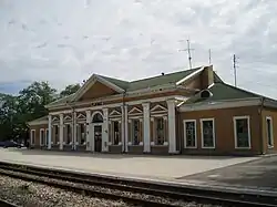 Pļaviņas train station | |
 Flag  Coat of arms | |
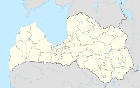 Pļaviņas Location in Latvia | |
| Coordinates: 56°36′N 25°43′E / 56.600°N 25.717°E | |
| Country | |
| Municipality | Aizkraukle Municipality |
| Town rights | 1927 |
| Area | |
| • Total | 7.04 km2 (2.72 sq mi) |
| • Land | 5.67 km2 (2.19 sq mi) |
| • Water | 1.37 km2 (0.53 sq mi) |
| Population (2023)[2] | |
| • Total | 2,821 |
| • Density | 400/km2 (1,000/sq mi) |
| Time zone | UTC+2 (EET) |
| • Summer (DST) | UTC+3 (EEST) |
| Postal code | LV-512(0-1) |
| Calling code | +371 651 |
| Website | http://www.plavinas.lv/ |
Pļaviņas (ⓘ; German: Stockmannshof) is a town in Aizkraukle Municipality in Latvia. The town is located on the Daugava river. The population in 2020 was 2,974.[3] Latvian law defines the town of Pļaviņas as belonging partly to the Vidzeme region and partly to Latgale.[4]
See also
References
- ↑ "Reģionu, novadu, pilsētu un pagastu kopējā un sauszemes platība gada sākumā". Central Statistical Bureau of Latvia. Retrieved 18 January 2023.
- ↑ "Iedzīvotāju skaits pēc tautības reģionos, pilsētās, novados, pagastos, apkaimēs un blīvi apdzīvotās teritorijās gada sākumā (pēc administratīvi teritoriālās reformas 2021. gadā) 2021 - 2022". Central Statistical Bureau of Latvia. Retrieved 3 October 2023.
- ↑ "ISG020. Population number and its change by statistical region, city, town, 21 development centres and county". Central Statistical Bureau of Latvia. 2020-01-01. Retrieved 2021-02-12.
- ↑ Latviešu vēsturisko zemju likums
External links
Wikimedia Commons has media related to Pļaviņas.
This article is issued from Wikipedia. The text is licensed under Creative Commons - Attribution - Sharealike. Additional terms may apply for the media files.