Paharpur | |
|---|---|
town | |
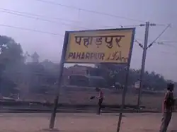 Paharpur railway station | |
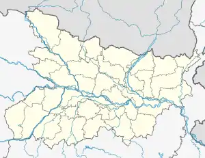 Paharpur Location in Bihar, India | |
| Coordinates: 24°36′26″N 85°12′29″E / 24.607106°N 85.207943°E | |
| Country | |
| State | Bihar |
| District | Gaya |
| Population (2001) | |
| • Total | 5,758 |
| Languages | |
| • Official | Magahi, Hindi |
| Time zone | UTC+5:30 (IST) |
| ISO 3166 code | IN-BR |
Paharpur is a census town in Gaya district in the Indian state of Bihar.
Demographics
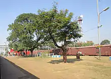
Paharpur railway station at Gaya district.
As of 2001 India census,[1] Paharpur had a population of 5758. Males constitute 68% of the population and females 32%. Paharpur has an average literacy rate of 78%, higher than the national average of 59.5%: male literacy is 84%, and female literacy is 64%. In Paharpur, 13% of the population is under 6 years of age.
References
- ↑ "Census of India 2001: Data from the 2001 Census, including cities, villages and towns (Provisional)". Census Commission of India. Archived from the original on 16 June 2004. Retrieved 1 November 2008.
This article is issued from Wikipedia. The text is licensed under Creative Commons - Attribution - Sharealike. Additional terms may apply for the media files.