Panfilov | |
|---|---|
District | |
| Панфилов ауданы | |
 | |
| Country | Kazakhstan |
| Region | Jetisu Region |
| Administrative center | Zharkent |
| Founded | 1928 |
| Government | |
| • Akim (mayor) | Sagymbek Marat Rahymberdievich[1] |
| Area | |
| • Total | 4,100 sq mi (10,600 km2) |
| Population (2019) | |
| • Total | 129,204 |
| Time zone | UTC+6 (East) |
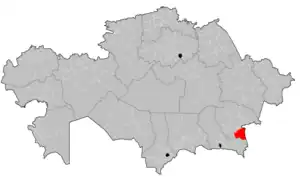
Panfilov District (Kazakh: Панфилов ауданы, Panfilov audany) is a district of Jetisu Region in Kazakhstan. The administrative center of the district is the town of Zharkent.[2] As of 2019, the district's population is 129,204.[3]
Demographics
Historic population
Panfilov District's population has steadily grown since the independence of Kazakhstan, with its population reaching 129,204 as of 2019;[3] 119,920 (2013 estimate);[4] 113,059 (2009 Census results);[5] 112,984 (1999 Census results).[5]
Ethnic groups
| Ethnic Group | Population (2019) | Percent of Total |
|---|---|---|
| Kazakh | 86,035 | 66.59% |
| Uighur | 36,745 | 28.44% |
| Russian | 4,561 | 3.53% |
| Tatar | 397 | 0.31% |
| Uzbek | 282 | 0.22% |
| Kyrgyz | 85 | 0.07% |
| Ukrainian | 76 | 0.06% |
| German | 59 | 0.05% |
| Koreans | 57 | 0.04% |
| Chechen | 45 | 0.03% |
| Azerbaijani | 20 | 0.02% |
| Turkish | 17 | 0.01% |
| Greek | 10 | 0.01% |
| Others | 815 | 0.63% |
| Total | 129,204 | 100.00% |
References
- ↑ "Акимат Панфиловского района". www.gov.kz.
- ↑ "www.geonames.de Subdivisions of Kazakhstan in local languages". Archived from the original on 2016-03-03. Retrieved 2008-04-21.
- 1 2 3 Численность населения Республики Казахстан по отдельным этносам на начало 2019 года (in Kazakh and Russian). Комитет по статистике Министерства национальной экономики Республики Казахстан. 2019. Retrieved 2020-05-19.
- ↑ "Население Республики Казахстан" (in Russian). Департамент социальной и демографической статистики. Retrieved 27 December 2013.
- 1 2 "Население Республики Казахстан" [Population of the Republic of Kazakhstan] (in Russian). Департамент социальной и демографической статистики. Retrieved 8 December 2013.
44°10′21″N 80°00′29″E / 44.1724°N 80.008°E
This article is issued from Wikipedia. The text is licensed under Creative Commons - Attribution - Sharealike. Additional terms may apply for the media files.