Panissage | |
|---|---|
Part of Val-de-Virieu | |
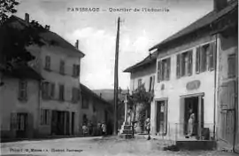 The industrial quarter of Panissage around 1920 | |
Location of Panissage | |
 Panissage  Panissage | |
| Coordinates: 45°29′41″N 5°27′49″E / 45.4947°N 5.4636°E | |
| Country | France |
| Region | Auvergne-Rhône-Alpes |
| Department | Isère |
| Arrondissement | La Tour-du-Pin |
| Canton | Le Grand-Lemps |
| Commune | Val-de-Virieu |
| Area 1 | 4.88 km2 (1.88 sq mi) |
| Population (2018)[1] | 445 |
| • Density | 91/km2 (240/sq mi) |
| Time zone | UTC+01:00 (CET) |
| • Summer (DST) | UTC+02:00 (CEST) |
| Postal code | 38730 |
| Elevation | 381–636 m (1,250–2,087 ft) (avg. 406 m or 1,332 ft) |
| 1 French Land Register data, which excludes lakes, ponds, glaciers > 1 km2 (0.386 sq mi or 247 acres) and river estuaries. | |
Panissage (French pronunciation: [panisaʒ]) is a former commune in the Isère department in southeastern France. On 1 January 2019, it was merged into the new commune Val-de-Virieu.[2]
Geography
The Bourbre forms the commune's southeastern border.
Population
|
|
See also
References
Wikimedia Commons has media related to Panissage.
- ↑ Téléchargement du fichier d'ensemble des populations légales en 2018, INSEE
- ↑ Arrêté préfectoral 11 October 2018, p. 275 (in French)
This article is issued from Wikipedia. The text is licensed under Creative Commons - Attribution - Sharealike. Additional terms may apply for the media files.