Pelican Marsh, Florida | |
|---|---|
 Pelican Marsh  Pelican Marsh | |
| Coordinates: 26°15′13″N 81°46′56″W / 26.25361°N 81.78222°W | |
| Country | |
| State | Florida |
| County | Collier |
| Area | |
| • Total | 2.10 sq mi (5.44 km2) |
| • Land | 1.94 sq mi (5.04 km2) |
| • Water | 0.16 sq mi (0.41 km2) |
| Elevation | 12 ft (4 m) |
| Population (2020) | |
| • Total | 2,453 |
| • Density | 1,261.83/sq mi (487.15/km2) |
| Time zone | UTC-5 (Eastern (EST)) |
| • Summer (DST) | UTC-4 (EDT) |
| ZIP Codes | 34108, 34109 (Naples) |
| Area code | 239 |
| FIPS code | 12-55680 |
| GNIS feature ID | 2806007[2] |
Pelican Marsh is a census-designated place (CDP) in northwestern Collier County, Florida, United States. It is bordered to the west by Naples Park and to the south by Pine Ridge, and it is 8 miles (13 km) north of Naples. U.S. Route 41 (Tamiami Trail) forms the western edge of the community.
Pelican Marsh was first listed as a CDP prior to the 2020 census.
Demographics
| Census | Pop. | Note | %± |
|---|---|---|---|
| 2020 | 2,453 | — | |
| U.S. Decennial Census[3] | |||
References
- ↑ "2020 U.S. Gazetteer Files". United States Census Bureau. Retrieved October 31, 2021.
- 1 2 "Pelican Marsh Census Designated Place". Geographic Names Information System. United States Geological Survey, United States Department of the Interior.
- ↑ "Census of Population and Housing". Census.gov. Retrieved June 4, 2016.
Municipalities and communities of Collier County, Florida, United States | ||
|---|---|---|
| Cities | 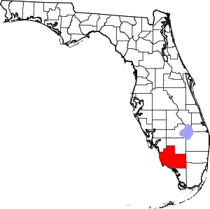 | |
| CDPs | ||
| Unincorporated communities | ||
| Proposed communities | ||
| Ghost towns | ||
This article is issued from Wikipedia. The text is licensed under Creative Commons - Attribution - Sharealike. Additional terms may apply for the media files.