Peoria, Oregon | |
|---|---|
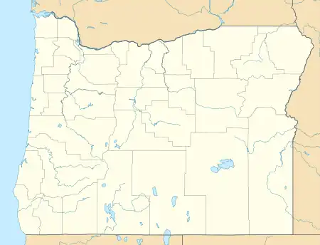
.jpg.webp) Willamette River at Peoria | |
 Peoria  Peoria | |
| Coordinates: 44°27′03″N 123°12′15″W / 44.45083°N 123.20417°W | |
| Country | United States |
| State | Oregon |
| County | Linn |
| Area | |
| • Total | 0.47 sq mi (1.23 km2) |
| • Land | 0.47 sq mi (1.23 km2) |
| • Water | 0.00 sq mi (0.00 km2) |
| Elevation | 259 ft (79 m) |
| Population | |
| • Total | 103 |
| • Density | 216.84/sq mi (83.72/km2) |
| Time zone | UTC-8 (Pacific) |
| • Summer (DST) | UTC-7 (Pacific) |
| Area code | 541 |
| FIPS code | 41-57300 |
| GNIS feature ID | 2584420[2] |
Peoria is an unincorporated community and census-designated place (CDP) in Linn County, Oregon, United States.[2] It is on the right bank of the Willamette River at river mile 141 between Eugene and Corvallis. Lacking stores and services, it is a cluster of houses plus a county park along Peoria Road, about 8 miles (13 km) south of Oregon Route 34 and 12 miles (19 km) north of Harrisburg.[4] As of the 2010 census, the population was 94.[5]
History
Peoria, named for Peoria, Illinois, was first settled in 1851 by H. A. McCartney. By 1875, the community was prosperous enough to have four grain warehouses and a school with 60 pupils. However, after the Oregon and California Railroad established a line through Shedd and Halsey further east, business in Peoria declined.[6]
A post office in this vicinity opened in 1855 under the name "Burlington". The name was changed to "Peoria" in 1857, and the office closed in 1900.[6] Through the early decades of the 20th century, a river ferry operated out of Peoria.[7]
Demographics
| Census | Pop. | Note | %± |
|---|---|---|---|
| 2020 | 103 | — | |
| U.S. Decennial Census[8][3] | |||
References
- ↑ "ArcGIS REST Services Directory". United States Census Bureau. Retrieved October 12, 2022.
- 1 2 3 U.S. Geological Survey Geographic Names Information System: Peoria, Oregon
- 1 2 "Census Population API". United States Census Bureau. Retrieved October 12, 2022.
- ↑ Google Maps
- ↑ "Total Population: 2010 Census DEC Summary File 1 (P1), Peoria CDP, Oregon". data.census.gov. U.S. Census Bureau. Retrieved August 25, 2020.
- 1 2 McArthur, Lewis A.; Lewis L. McArthur (2003) [1928]. Oregon Geographic Names (7th ed.). Portland, Oregon: Oregon Historical Society Press. p. 753. ISBN 0-87595-277-1.
- ↑ Williams, Travis (2009). The Willamette River Field Guide. Portland, Oregon: Timber Press. pp. 100–03. ISBN 978-0-88192-866-2.
- ↑ "Census of Population and Housing". Census.gov. Retrieved June 4, 2016.
External links
- Historic images of Peoria from the Salem Public Library
- Images of Peoria from the University of Oregon digital archives
- Images of Peoria from Flickr
Municipalities and communities of Linn County, Oregon, United States | ||
|---|---|---|
| Cities | 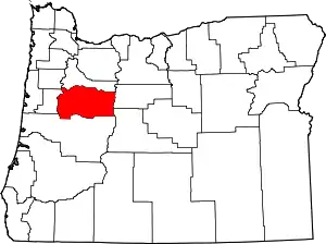 Linn County map | |
| CDPs | ||
| Other communities | ||
| Ghost towns | ||
| Indian reservation | ||
| Footnotes | ‡This populated place also has portions in an adjacent county or counties | |