Pietrarubbia | |
|---|---|
| Comune di Pietrarubbia | |
 | |
 Coat of arms | |
Location of Pietrarubbia | |
 Pietrarubbia Location of Pietrarubbia in Italy 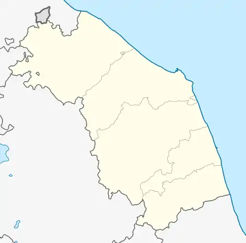 Pietrarubbia Pietrarubbia (Marche) | |
| Coordinates: 43°48′N 12°23′E / 43.800°N 12.383°E | |
| Country | Italy |
| Region | Marche |
| Province | Pesaro e Urbino (PU) |
| Frazioni | La Badia, Ca' Baldissera, Ca' Bartolino, Ca' Boso, Ca' Carbone, Ca' Ivano, Ca' Maluccio, Ca' Mancino, Ca' Volanino, Lago del Conte, Mercato Vecchio, Pontecappuccini, Villa del Piano. |
| Government | |
| • Mayor | Luciano Vergari |
| Area | |
| • Total | 13.0 km2 (5.0 sq mi) |
| Elevation | 572 m (1,877 ft) |
| Population (2008)[2] | |
| • Total | 718 |
| • Density | 55/km2 (140/sq mi) |
| Demonym | Pietrarubbiesi |
| Time zone | UTC+1 (CET) |
| • Summer (DST) | UTC+2 (CEST) |
| Postal code | 61020 |
| Dialing code | 0722 |
| Patron saint | St. Anthony of Padua |
| Saint day | 13 June |
| Website | Official website |
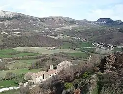
Pietrarubbia is a comune (municipality) in the Province of Pesaro e Urbino in the Italian region Marche, located about 90 kilometres (56 mi) west of Ancona and about 45 kilometres (28 mi) southwest of Pesaro.
It is home to an 11th-century castle which, according to tradition, is the ancestral home of the house of Montefeltro, rulers of the area in the Middle Ages and the Renaissance.
Neighboring municipalities: Carpegna, Frontino, Macerata Feltria, Montecopiolo, Piandimeleto.
References
- ↑ "Superficie di Comuni Province e Regioni italiane al 9 ottobre 2011". Italian National Institute of Statistics. Retrieved 16 March 2019.
- ↑ All demographics and other statistics: Italian statistical institute Istat.
This article is issued from Wikipedia. The text is licensed under Creative Commons - Attribution - Sharealike. Additional terms may apply for the media files.