| Pine Creek South Australia | |||||||||||||||
|---|---|---|---|---|---|---|---|---|---|---|---|---|---|---|---|
  Pine Creek | |||||||||||||||
| Coordinates | 33°10′S 139°17′E / 33.17°S 139.29°E[1] | ||||||||||||||
| Population | 0 (2016 census)[2] | ||||||||||||||
| Postcode(s) | 5419[3] | ||||||||||||||
| LGA(s) | Regional Council of Goyder[1] | ||||||||||||||
| Region | Yorke and Mid North[1] | ||||||||||||||
| County | Kimberley[1] | ||||||||||||||
| State electorate(s) | Stuart[4] | ||||||||||||||
| Federal division(s) | Grey[5] | ||||||||||||||
| |||||||||||||||
| Footnotes | Adjoining localities[1] | ||||||||||||||
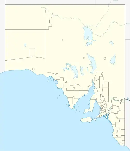
Pine Creek is a rural locality in the Mid North region of South Australia, situated in the Regional Council of Goyder.[3] It was established in August 2000 when boundaries were formalised for the long established local name.[6]
| Ketchowla South Australia | |||||||||||||||
|---|---|---|---|---|---|---|---|---|---|---|---|---|---|---|---|
| Population | 0 (SAL 2016)[7][8] | ||||||||||||||
| Established | 5 August 1880 | ||||||||||||||
| Area | 410 km2 (157 sq mi) | ||||||||||||||
| County | Kimberley | ||||||||||||||
| |||||||||||||||
The Hundred of Ketchowla is a cadastral unit of hundred, the boundaries of which are exactly contiguous with the locality of Pine Creek.[3] The hundred was proclaimed by Governor William Jervois on 5 August 1880, named for an Aboriginal name of unknown origin.[9]
Ketchowla Station is named after the hundred and the station's homestead is located within Pine Creek.[6] A post office at Ketchowla opened circa 1872 and closed on 30 November 1917.[10] The Ketchowla Woolshed, Old Homestead and Outbuildings are listed on the South Australian Heritage Register.[11]
The 2016 Australian census which was conducted in August 2016 reports that Pine Creek had no people living within its boundaries.[2]
Note that there are several creeks in South Australia called Pine Creek, including a tributary that joins the River Wakefield at Undalya and forms part of the boundary between the Hundred of Upper Wakefield[12] and the Hundred of Saddleworth.[13]
See also
References
- 1 2 3 4 5 "Search results for 'Pine Creek, LOCB' with the following datasets selected – 'Suburbs and localities', 'Counties', 'Hundreds', 'Local Government Areas', 'SA Government Regions' and 'Gazetteer'". Location SA Map Viewer. South Australian Government. Retrieved 25 December 2018.
- 1 2 Australian Bureau of Statistics (27 June 2017). "Pine Creek (State Suburb)". 2016 Census QuickStats. Retrieved 25 December 2018.
- 1 2 3 "Search result(s) for Pine Creek, 5419". Location SA Map Viewer. Government of South Australia. Retrieved 16 February 2016.
- ↑ "District of Stuart Background Profile (2014-2018 boundaries)". Electoral Commission SA. Retrieved 27 December 2017.
- ↑ "Federal electoral division of Grey" (PDF). Australian Electoral Commission. Retrieved 27 December 2017.
- 1 2 "Search result(s) for Pine Creek, 5419". Property Location Browser. Government of South Australia. Archived from the original on 12 October 2016. Retrieved 17 February 2016.
- ↑ Australian Bureau of Statistics (27 June 2017). "Pine Creek (suburb and locality)". Australian Census 2016.
- ↑ Australian Bureau of Statistics (27 June 2017). "Pine Creek (SA) (suburb and locality)". Australian Census 2016 QuickStats. Retrieved 28 June 2022.
- ↑ "Search result(s) for Hundred of Ketchowla". Property Location Browser. Government of South Australia. Archived from the original on 12 October 2016. Retrieved 17 February 2016.
- ↑ "Ketchowla". Post Office Reference. Premier Postal. Retrieved 4 May 2016.
- ↑ "Ketchowla Woolshed, Old Homestead & Outbuildings to Old Homestead". South Australian Heritage Register. Department of Environment, Water and Natural Resources, Government of South Australia. Retrieved 4 May 2016.
- ↑ Map of the Hundred of Upper Wakefield: Surveyor General's Office, Adelaide, A. Vaughan Photo-lithographer, August 1893.
- ↑ Map of the Hundred of Saddleworth: Surveyor General's Office, Adelaide, A. Vaughan Photo-lithographer, November 1891.
.jpg)
.jpg)