Piro | |
|---|---|
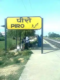 Piro railway station | |
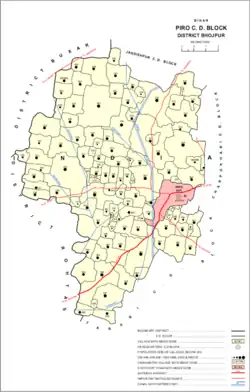 Location of Piro block in Bhojpur District | |
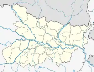 Piro Location in Bihar, India | |
| Coordinates: 25°20′N 84°25′E / 25.33°N 84.42°E | |
| Country | |
| State | Bihar |
| District | Bhojpur |
| Government | |
| • Type | Piro Nagar Parishad |
| • Body | Municipal Corporation |
| • M.L.A | Sudama Prasad |
| Elevation | 72 m (236 ft) |
| Population (2016)[1] | |
| • Total | 45,000 |
| Time zone | UTC+5:30 (IST) |
| PIN | 802207 |
| Telephone code | 06181 |
| Vehicle registration | BR-03 |
| Website | bhojpur |
Piro is a nagar parishad town and corresponding community development block in Bhojpur District, in the Indian state of Bihar.
Geography
Piro is located at 25°20′N 84°25′E / 25.33°N 84.42°E.[2] It has an average elevation of 72 metres (236 feet).
Demographics
| Year | Pop. | ±% |
|---|---|---|
| 1981 | 14,068 | — |
| 1991 | 18,419 | +30.9% |
| 2001 | 25,811 | +40.1% |
| 2011 | 33,785 | +30.9% |
| Source: 2011 Census of India[3] | ||
As of 2001 India census,[4] Piro had a population of 25,638. Males constitute 53% of the population and females 47%. Piro has an average literacy rate of 56%, lower than the national average of 59.5%: male literacy is 65%, and female literacy is 45%.
In Piro, 18% of the population is under 6 years of age.
As of 2011 the population of the town of Piro was 45,000 in 7,033 households.[3]
Administration
The Piro sub-division (Tehsil) is headed by an IAS or state Civil service officer of the rank of Sub Divisional Magistrate (SDM).
Blocks
The Piro Tehsil is divided into 3 Blocks, each headed by a Block Development Officer (BDO). List of Blocks is as follows:
- Piro
- Charpokhari
- Tarari
Piro Balua Tola is one of the most developed village in Piro block.
List of villages
Piro block contains the following 109 villages:[3]
| Village name | Total land area (hectares) | Population (in 2011) |
|---|---|---|
| Lohain | 166 | 2,000 |
| Balua Tola | 85 | 1620 |
| Newari | 201 | 843 |
| Khairahin | 110 | 616 |
| Kheri Kon | 263 | 2,016 |
| Pharaura | 237 | 1,698 |
| Karauniya | 91 | 1,052 |
| Ear | 404 | 3,821 |
| Kukrahan | 130 | 955 |
| Waina | 296 | 1,585 |
| Danwarua | 148 | 1,436 |
| Tar | 943 | 6,123 |
| Jamuaon | 452 | 5,006 |
| Saneya | 74 | 1,843 |
| Bamhawar | 201 | 4,190 |
| Chaubepur | 85 | 1,041 |
| Marohi | 61 | 340 |
| Chhaurahi Jangal Mahal | 766 | 5,949 |
| Keshwa | 277 | 3,018 |
| Bishambharpur | 14 | 0 |
| Haswa Dehri | 132 | 1,530 |
| Rajapur | 98 | 1,588 |
| Akrua | 395 | 3,309 |
| Kaser | 122 | 844 |
| Barao | 625 | 7,230 |
| Hat Pokhar | 77 | 1,272 |
| Jitaura Jangal Mahal | 969 | 11,292 |
| Rajeyan | 149 | 2,561 |
| Baseya | 230 | 1,943 |
| Mahwari | 75 | 1,081 |
| Doman Dehra | 221 | 2,033 |
| Khambha Dih | 51 | 427 |
| Chanwa | 36 | 0 |
| Puraini Buzurg | 80 | 1,000 |
| Puraini Khurd | 40 | 234 |
| Pitro | 202 | 3,418 |
| Khandani | 262 | 2,266 |
| Khandani Khurd | 146 | 1,516 |
| Angra | 371.1 | 2,384 |
| Pitat | 217.4 | 892 |
| Kothua | 309 | 2,770 |
| Dhanpura | 231 | 1,686 |
| Birpur | 87 | 769 |
| Salakhna | 123.9 | 656 |
| Mahuari | 140 | 1,060 |
| Kewatia | 146 | 1,145 |
| Basdiha | 171 | 1,212 |
| Amehta | 191 | 3,052 |
| Lahthan | 898 | 6,516 |
| Anuwan | 68 | 347 |
| Telar | 214 | 2,930 |
| Agiaon | 373 | 7,545 |
| Baraura | 43 | 192 |
| Beduwa | 31 | 0 |
| Bedauli | 27 | 0 |
| Narhi | 63 | 1,215 |
| Narayanpur | 112 | 1,358 |
| Dihri | 102 | 999 |
| Baghaunr | 99 | 1,343 |
| Sugibal | 86 | 547 |
| Mothi | 168 | 1,567 |
| Mothibal Jangal Mahal | 31 | 375 |
| Jagdishpur Patak | 96 | 769 |
| Bahri Mahadeo | 26.5 | 0 |
| Naek Tola Jangal Mahal | 646 | 6,860 |
| Barauli | 176 | 1,705 |
| Tewari Dih | 68 | 891 |
| Rangal Tola Jangal Mahal | 47 | 669 |
| Sukhrauli | 165 | 1,766 |
| Jagdeopur | 59 | 436 |
| Gogsand | 62 | 937 |
| Kataria | 496 | 3,841 |
| Basmanpur | 179 | 1,894 |
| Amai | 317.9 | 3,826 |
| Tetar Dih | 151 | 1,726 |
| Sahejani | 308 | 2,958 |
| Rasauli | 121 | 1,954 |
| Jamunipur | 103 | 559 |
| Indarpatpur | 36 | 438 |
| Chhechhu Dih | 17 | 492 |
| Moti Dih | 40 | 538 |
| Pachrukhia | 235 | 2,464 |
| Kachnath | 151 | 1,769 |
| Udan Dih | 41 | 484 |
| Ujjain Dehra | 92.9 | 599 |
| Ojhawaliya | 20 | 265 |
| Lohrabad | 29 | 1,601 |
| Gajra Dih | 39 | 0 |
| Deochanda | 169 | 1,170 |
| Tilath | 295 | 2,886 |
| Jaisingh Dih | 170 | 1,470 |
| Manaini | 34 | 238 |
| Tiwari Dih | 99 | 1,177 |
| Itamba Ganesh | 57 | 856 |
| Chilbilia | 92 | 966 |
| Khorain | 27 | 0 |
| Dano Dih | 31 | 0 |
| Bachri | 257 | 3,476 |
| Bharsar | 325 | 2,861 |
| Gobind Dih | 118 | 1,414 |
| Nonar | 677 | 7,835 |
| Baisa Dih | 89.5 | 1,671 |
| Pachman | 250 | 2,344 |
| Katar | 594 | 13,484 |
| Garahatha | 121.8 | 1,120 |
| Harpur | 30 | 0 |
| Narayanpur | 442 | 6,232 |
| Jamaurahi | 150.7 | 2,128 |
| Bhulkua | 151 | 1,427 |
| Kachhuhi | 57 | 776 |
| Dhan Pokhar | 124 | 783 |
| Pasaur Tola | 85 | 790 |
References
- ↑ "Census of India Search details". censusindia.gov.in. Retrieved 10 May 2015.
- ↑ Falling Rain Genomics, Inc - Piro
- 1 2 3 "Census of India 2011: Bihar District Census Handbook - Bhojpur, Part A (Village and Town Directory)". Census 2011 India. pp. 46, 63, 81–83, 90, 92, 516–563, 753, 808–809. Retrieved 7 August 2020.
- ↑ "Census of India 2001: Data from the 2001 Census, including cities, villages and towns (Provisional)". Census Commission of India. Archived from the original on 16 June 2004. Retrieved 1 November 2008.