Polch | |
|---|---|
 Coat of arms | |
Location of Polch within Mayen-Koblenz district 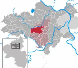 | |
 Polch 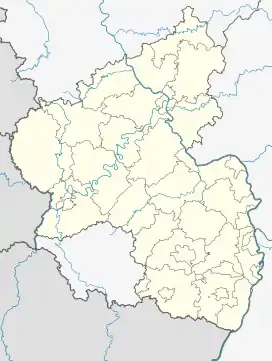 Polch | |
| Coordinates: 50°18′04″N 7°19′00″E / 50.30111°N 7.31667°E | |
| Country | Germany |
| State | Rhineland-Palatinate |
| District | Mayen-Koblenz |
| Municipal assoc. | Maifeld |
| Government | |
| • Mayor (2019–24) | Gerd Klasen[1] |
| Area | |
| • Total | 28.70 km2 (11.08 sq mi) |
| Elevation | 219 m (719 ft) |
| Population (2021-12-31)[2] | |
| • Total | 6,939 |
| • Density | 240/km2 (630/sq mi) |
| Time zone | UTC+01:00 (CET) |
| • Summer (DST) | UTC+02:00 (CEST) |
| Postal codes | 56751 |
| Dialling codes | 02654 |
| Vehicle registration | MYK, MY |
| Website | www.polch.de |
Polch (German pronunciation: [pɔlç] ⓘ) is a town in the district Mayen-Koblenz, Rhineland-Palatinate, Germany. It is part of the Verbandsgemeinde ("collective municipality") of Maifeld. It is situated east of Mayen.
Polch is twinned with the commune of Vineuil, located near Blois, Centre-Val de Loire, France
Local council (Stadtrat)
Elections were held in May 2014:[3]
| Election | SPD | CDU | The Left | FWG Free voters | Total |
|---|---|---|---|---|---|
| 2014 | 7 | 11 | 1 | 3 | 22 seats |
| 2009 | 9 | 10 | – | 3 | 22 seats |
| 2004 | 6 | 14 | – | 2 | 22 seats |
- FWG = Freie Wählergruppe Polch e.V.
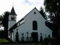 Saint George's church
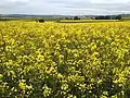 Canola field near Polch
References
- ↑ Direktwahlen 2019, Landkreis Mayen-Koblenz, Landeswahlleiter Rheinland-Pfalz, accessed 5 August 2021.
- ↑ "Bevölkerungsstand 2021, Kreise, Gemeinden, Verbandsgemeinden" (in German). Statistisches Landesamt Rheinland-Pfalz. 2022.
- ↑ Der Landeswahlleiter Rheinland-Pfalz: Kommunalwahl 2014, Stadt- und Gemeinderatswahlen
This article is issued from Wikipedia. The text is licensed under Creative Commons - Attribution - Sharealike. Additional terms may apply for the media files.