Poligny | |
|---|---|
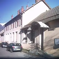 Town hall | |
 Coat of arms | |
Location of Poligny | |
 Poligny 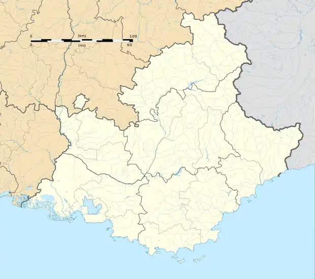 Poligny | |
| Coordinates: 44°41′33″N 6°02′52″E / 44.6925°N 6.0478°E | |
| Country | France |
| Region | Provence-Alpes-Côte d'Azur |
| Department | Hautes-Alpes |
| Arrondissement | Gap |
| Canton | Saint-Bonnet-en-Champsaur |
| Government | |
| • Mayor (2020–2026) | Eric Berdiel[1] |
| Area 1 | 13.81 km2 (5.33 sq mi) |
| Population | 337 |
| • Density | 24/km2 (63/sq mi) |
| Time zone | UTC+01:00 (CET) |
| • Summer (DST) | UTC+02:00 (CEST) |
| INSEE/Postal code | 05104 /05500 |
| Elevation | 896–2,082 m (2,940–6,831 ft) (avg. 1,062 m or 3,484 ft) |
| 1 French Land Register data, which excludes lakes, ponds, glaciers > 1 km2 (0.386 sq mi or 247 acres) and river estuaries. | |
Poligny (French pronunciation: [pɔliɲi] ⓘ) is a commune in the Hautes-Alpes department in southeastern France.
Population
| Year | Pop. | ±% |
|---|---|---|
| 1962 | 254 | — |
| 1968 | 262 | +3.1% |
| 1975 | 232 | −11.5% |
| 1982 | 219 | −5.6% |
| 1990 | 237 | +8.2% |
| 1999 | 230 | −3.0% |
| 2008 | 305 | +32.6% |
See also
References
- ↑ "Répertoire national des élus: les maires". data.gouv.fr, Plateforme ouverte des données publiques françaises (in French). 2 December 2020.
- ↑ "Populations légales 2021". The National Institute of Statistics and Economic Studies. 28 December 2023.
Wikimedia Commons has media related to Poligny, Hautes-Alpes.
This article is issued from Wikipedia. The text is licensed under Creative Commons - Attribution - Sharealike. Additional terms may apply for the media files.