| Pongola River uPhongolo | |
|---|---|
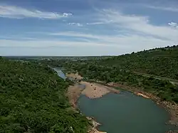 Pongola river, immediately below Pongolapoort Dam | |
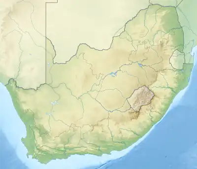 Location of the Pongola River mouth | |
| Etymology | From the Zulu for 'trough-like', 'river of troughs', referring to long pools.[1] |
| Location | |
| Country | South Africa, Mozambique |
| Physical characteristics | |
| Source | |
| • location | Near Utrecht, KwaZulu-Natal, South Africa |
| Mouth | Maputo River |
• location | Maputo Province, Mozambique |
• coordinates | 26°51′21″S 32°20′47″E / 26.85583°S 32.34639°E |
• elevation | 29 m (95 ft) |
The Phongolo River is a river in South Africa. It is a tributary of the Maputo River. It rises near Utrecht in northern KwaZulu-Natal, flows east through oPhongolo, is dammed at Pongolapoort, and crosses the Ubombo Mountains; then it flows north towards Mozambique, joining the Maputo River. [2]
Its main tributaries are the Bivane River and the Mozana River in South Africa, as well as the Ngwavuma in Eswatini.[3]
.jpg.webp)
The Pongolo River winding through hills in and beyond the Ithala Game Reserve
See also
References
- ↑ Raper, P. E. (1989). Dictionary of Southern African Place Names. Jonathan Ball Publishers. p. 363. ISBN 978-0-947464-04-2 – via Internet Archive.
- ↑ van Vuuren, Lani (May 2009), "Darlington Dam: Development Steeped in Controversy" (PDF), The Water Wheel, Gezina: South African Water Research Commission, vol. 8, no. 3, pp. 23–27, ISSN 0258-2244, archived from the original (PDF) on 19 July 2011, retrieved 10 April 2010
- ↑ "Usuthu/Mhlatuze WMA 6". Department of Water Affairs and Fisheries.
This article is issued from Wikipedia. The text is licensed under Creative Commons - Attribution - Sharealike. Additional terms may apply for the media files.