Ponte Lambro | |
|---|---|
| Comune di Ponte Lambro | |
 Coat of arms | |
Location of Ponte Lambro | |
 Ponte Lambro Location of Ponte Lambro in Italy 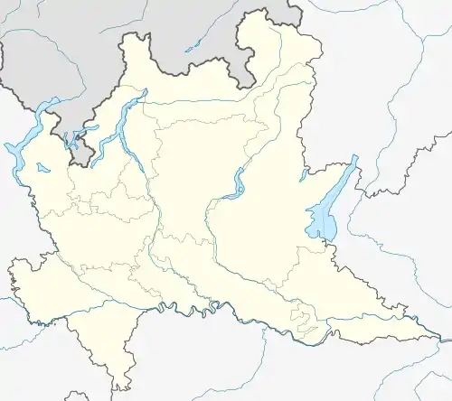 Ponte Lambro Ponte Lambro (Lombardy) | |
| Coordinates: 45°50′N 9°14′E / 45.833°N 9.233°E | |
| Country | Italy |
| Region | Lombardy |
| Province | Como (CO) |
| Frazioni | Lezza, Mazzonio, Fucina, Schieppo, Busnigallo |
| Area | |
| • Total | 3.4 km2 (1.3 sq mi) |
| Population (Dec. 2004)[2] | |
| • Total | 4,145 |
| • Density | 1,200/km2 (3,200/sq mi) |
| Demonym | Pontelambresi |
| Time zone | UTC+1 (CET) |
| • Summer (DST) | UTC+2 (CEST) |
| Postal code | 22037 |
| Dialing code | 031 |
| Patron saint | S. Maria Annunciata |
Ponte Lambro (Brianzöö: Punt [ˈpũːt]) is a comune (municipality) in the Province of Como in the Italian region Lombardy, located about 40 kilometres (25 mi) north of Milan and about 12 kilometres (7 mi) east of Como.
Ponte Lambro borders the following municipalities: Caslino d'Erba, Castelmarte, Erba.
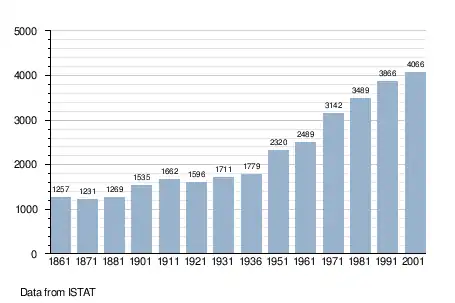
Demographic evolution
Twin towns
 Zawiercie, Poland, since 2004
 Kamianets-Podilskyi, Ukraine, since 2006
 Cortale, Italy, since 2010
- Carbone, Italy, since 2010
References
- ↑ "Superficie di Comuni Province e Regioni italiane al 9 ottobre 2011". Italian National Institute of Statistics. Retrieved 16 March 2019.
- ↑ All demographics and other statistics: Italian statistical institute, Istat.
This article is issued from Wikipedia. The text is licensed under Creative Commons - Attribution - Sharealike. Additional terms may apply for the media files.