Pontfaverger-Moronvilliers | |
|---|---|
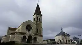 The church in Pontfaverger | |
 Coat of arms | |
Location of Pontfaverger-Moronvilliers | |
 Pontfaverger-Moronvilliers  Pontfaverger-Moronvilliers | |
| Coordinates: 49°17′51″N 4°19′13″E / 49.2975°N 4.3203°E | |
| Country | France |
| Region | Grand Est |
| Department | Marne |
| Arrondissement | Reims |
| Canton | Mourmelon-Vesle et Monts de Champagne |
| Intercommunality | CU Grand Reims |
| Government | |
| • Mayor (2020–2026) | Damien Girard[1] |
| Area 1 | 31.52 km2 (12.17 sq mi) |
| Population | 1,740 |
| • Density | 55/km2 (140/sq mi) |
| Time zone | UTC+01:00 (CET) |
| • Summer (DST) | UTC+02:00 (CEST) |
| INSEE/Postal code | 51440 /51490 |
| 1 French Land Register data, which excludes lakes, ponds, glaciers > 1 km2 (0.386 sq mi or 247 acres) and river estuaries. | |
Pontfaverger-Moronvilliers (French pronunciation: [pɔ̃favɛʁʒe mɔʁɔ̃vilje]) is a commune in the Marne department in north-eastern France.[3]
Before 1950, when it absorbed part of the territory of Moronvilliers, its name was Pontfaverger.[3][4] Moronvilliers was destroyed during World War I and never rebuilt.
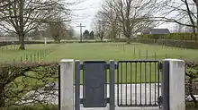
German cemetery, World War I.
Geography
The commune is traversed by the Suippe river.
See also
References
- ↑ "Répertoire national des élus: les maires" (in French). data.gouv.fr, Plateforme ouverte des données publiques françaises. 13 September 2022.
- ↑ "Populations légales 2021". The National Institute of Statistics and Economic Studies. 28 December 2023.
- 1 2 Commune de Pontfaverger-Moronvilliers (51440), INSEE
- ↑ Commune de Moronvilliers (51385), commune périmée, INSEE
Wikimedia Commons has media related to Pontfaverger-Moronvilliers.
This article is issued from Wikipedia. The text is licensed under Creative Commons - Attribution - Sharealike. Additional terms may apply for the media files.