Prokopov | |
|---|---|
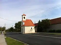 Chapel of the Virgin Mary | |
 Flag  Coat of arms | |
 Prokopov Location in the Czech Republic | |
| Coordinates: 48°59′54″N 15°53′46″E / 48.99833°N 15.89611°E | |
| Country | |
| Region | South Moravian |
| District | Znojmo |
| First mentioned | 1789 |
| Area | |
| • Total | 2.45 km2 (0.95 sq mi) |
| Elevation | 388 m (1,273 ft) |
| Population (2023-01-01)[1] | |
| • Total | 95 |
| • Density | 39/km2 (100/sq mi) |
| Time zone | UTC+1 (CET) |
| • Summer (DST) | UTC+2 (CEST) |
| Postal code | 671 54 |
| Website | www |
Prokopov (German: Prokopsdorf) is a municipality and village in Znojmo District in the South Moravian Region of the Czech Republic. It has about 100 inhabitants.
Prokopov lies approximately 19 kilometres (12 mi) north-west of Znojmo, 58 km (36 mi) south-west of Brno, and 162 km (101 mi) south-east of Prague.
References
Wikimedia Commons has media related to Prokopov.
This article is issued from Wikipedia. The text is licensed under Creative Commons - Attribution - Sharealike. Additional terms may apply for the media files.