Highway 162 | ||||
|---|---|---|---|---|
| Ruta 162 | ||||
| Route information | ||||
| Maintained by Puerto Rico DTPW | ||||
| Length | 19.0 km[1][2] (11.8 mi) | |||
| Existed | 1953[3]–present | |||
| Major junctions | ||||
| South end | ||||
| North end | ||||
| Location | ||||
| Country | United States | |||
| Territory | Puerto Rico | |||
| Municipalities | Aibonito, Barranquitas | |||
| Highway system | ||||
| ||||


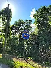
Puerto Rico Highway 162 (PR-162) is a road that travels from Aibonito, Puerto Rico to Barranquitas.[4] This highway begins at its intersection with PR-1 in Cuyón and ends at its junction with PR-156 in downtown Barranquitas.[5]
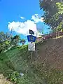
 Puerto Rico Highway 162 south in Helechal, Barranquitas
Major intersections
 PR-143 east near PR-162 junction in Helechal, Barranquitas
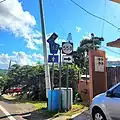 PR-162 south at PR-558 intersection in Helechal, Barranquitas
.jpg.webp) PR-162 north at PR-719 intersection in Helechal, Barranquitas
PR-162 north at PR-719 intersection in Helechal, Barranquitas
| Municipality | Location | km[1][2] | mi | Destinations | Notes | ||
|---|---|---|---|---|---|---|---|
| Aibonito | Cuyón | 0.0 | 0.0 | Southern terminus of PR-162 | |||
| 3.1 | 1.9 | ||||||
| Pasto–Cuyón line | 4.9 | 3.0 | |||||
| Pasto–Robles line | 6.4 | 4.0 | |||||
| Aibonito barrio-pueblo | 7.8 | 4.8 | |||||
| 8.5 50.3[lower-alpha 1] | 5.3 31.3 | Eastern terminus of PR-14 concurrency; one-way street; eastbound access via Calle Gerónimo Martínez; the Carretera Central continues toward Cayey | |||||
| See PR-14 | |||||||
| Pasto–Llanos– Asomante tripoint | 47.3[lower-alpha 1] 8.6 | 29.4 5.3 | Western terminus of PR-14 concurrency; the Carretera Central continues toward Coamo | ||||
| Asomante–Llanos line | 12.3– 12.4 | 7.6– 7.7 | |||||
| 12.8– 12.9 | 8.0– 8.0 | PR-7062 – Asomante | Unsigned | ||||
| Barranquitas | Helechal | 15.3– 15.4 | 9.5– 9.6 | ||||
| 15.9 | 9.9 | ||||||
| 16.4 | 10.2 | ||||||
| Barranquitas barrio-pueblo | 19.0 | 11.8 | Northern terminus of PR-162 | ||||
1.000 mi = 1.609 km; 1.000 km = 0.621 mi
| |||||||
See also
References
- 1 2 Google (25 March 2020). "PR-162 south" (Map). Google Maps. Google. Retrieved 25 March 2020.
- 1 2 Google (25 March 2020). "PR-162 north" (Map). Google Maps. Google. Retrieved 25 March 2020.
- ↑ "Aibonito, Memoria Núm. 43" (PDF). Puerto Rico Planning Board (in Spanish). 1955. Retrieved 4 August 2020.
- ↑ National Geographic Maps (2011). Puerto Rico (Map). 1:125,000. Adventure Map (Book 3107). Evergreen, Colorado: National Geographic Maps. ISBN 978-1566955188. OCLC 756511572.
- ↑ "Tránsito Promedio Diario (AADT)". Puerto Rico Department of Transportation and Public Works (in Spanish). pp. 85–86. Archived from the original on 1 April 2019. Retrieved 5 June 2019.
External links
 Media related to Puerto Rico Highway 162 at Wikimedia Commons
This article is issued from Wikipedia. The text is licensed under Creative Commons - Attribution - Sharealike. Additional terms may apply for the media files.