Highway 818 | ||||
|---|---|---|---|---|
| Ruta 818 | ||||
| Route information | ||||
| Maintained by Puerto Rico DTPW | ||||
| Length | 4.3 km[1] (2.7 mi) | |||
| Existed | 1953[2]–present | |||
| Major junctions | ||||
| West end | Sector Baja del Palo in Cibuco | |||
| East end | ||||
| Location | ||||
| Country | United States | |||
| Territory | Puerto Rico | |||
| Municipalities | Corozal | |||
| Highway system | ||||
| ||||

Puerto Rico Highway 818 (PR-818) is an east–west road located in the municipality of Corozal in Puerto Rico.[3] With a length of 4.3 km (2.7 mi), it begins at its junction with PR-159 in Barrio Pueblo,[4] and ends at Baja del Palo sector in Barrio Cibuco.
Route description
This highway consists of one lane in each direction along its entire length. In Barrio Pueblo, PR-818 heads to the west from PR-159 and serves as access to several neighborhood developments. In Cibuco, it crosses the Río Cibuco[5] and connects various rural sectors and some neighborhood developments until its end near the Vega Alta municipal limit.[6]
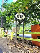 Sign for PR-818 in Barrio Pueblo, looking west
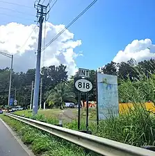 PR-159 west near PR-818 intersection in Barrio Pueblo
 Río Cibuco from PR-818 bridge
Major intersections
The entire route is located in Corozal.
| Location | km[1] | mi | Destinations | Notes | |
|---|---|---|---|---|---|
| Cibuco | 4.3 | 2.7 | Western terminus of PR-818 at Sector Baja del Palo | ||
| 2.5 | 1.6 | PR-817 | Northern terminus of PR-817; unsigned | ||
| Pueblo | 0.0 | 0.0 | Eastern terminus of PR-818 | ||
| 1.000 mi = 1.609 km; 1.000 km = 0.621 mi | |||||
See also
References
- 1 2 Google (29 February 2020). "PR-818" (Map). Google Maps. Google. Retrieved 29 February 2020.
- ↑ "Corozal, Memoria Núm. 61" (PDF). Puerto Rico Planning Board (in Spanish). 1955. Retrieved 22 February 2020.
- ↑ National Geographic Maps (2011). Puerto Rico (Map). 1:125,000. Adventure Map (Book 3107). Evergreen, Colorado: National Geographic Maps. ISBN 978-1566955188. OCLC 756511572.
- ↑ "Tránsito Promedio Diario (AADT)". Transit Data (Datos de Transito) (in Spanish). DTOP PR. p. 129. Archived from the original on 1 April 2019.
- ↑ Press, Detroit Free. "PR 818 over CIBUCO RIVER Corozal Municipio, Puerto Rico Bridge Inspection Report". Detroit Free Press. Retrieved 9 August 2023.
- ↑ "PR-818, Corozal, Puerto Rico". pr.geoview.info. Retrieved 7 February 2020.
External links
 Media related to Puerto Rico Highway 818 at Wikimedia Commons
This article is issued from Wikipedia. The text is licensed under Creative Commons - Attribution - Sharealike. Additional terms may apply for the media files.