Pukaki Airport | |||||||||||||||
|---|---|---|---|---|---|---|---|---|---|---|---|---|---|---|---|
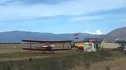 Pukaki Airport in 2014 | |||||||||||||||
| Summary | |||||||||||||||
| Airport type | Public | ||||||||||||||
| Operator | Pukaki Airport Authority | ||||||||||||||
| Location | Twizel, New Zealand | ||||||||||||||
| Elevation AMSL | 1,575 ft / 480 m | ||||||||||||||
| Coordinates | 44°14′13″S 170°7′8″E / 44.23694°S 170.11889°E | ||||||||||||||
| Website | http://www.airportpukaki.co.nz | ||||||||||||||
| Runways | |||||||||||||||
| |||||||||||||||
Pukaki Airport (IATA: TWZ, ICAO: NZUK) is a small airport in the Mackenzie District of the South Island of New Zealand. The airport is located about 3 km North from the township of Twizel and is 284 km from Christchurch.
The airport contains a fully automated Met Service weather station, thirteen hangars, and fuel supplies.
Resident operators offer charter and scenic flights from the aerodrome.
A record low temperature was set at Pukaki Airport of -19.8 °C on the morning of 23 June 2015.[1]
The airport was also one of the filming locations of the 2009 zombie movie Last of the Living.
See also
References
- ↑ "Temperatures returning to normal for most". Met Service. 25 June 2015.
External links
This article is issued from Wikipedia. The text is licensed under Creative Commons - Attribution - Sharealike. Additional terms may apply for the media files.