Pul Pehladpur
Pul Prahladpur | |
|---|---|
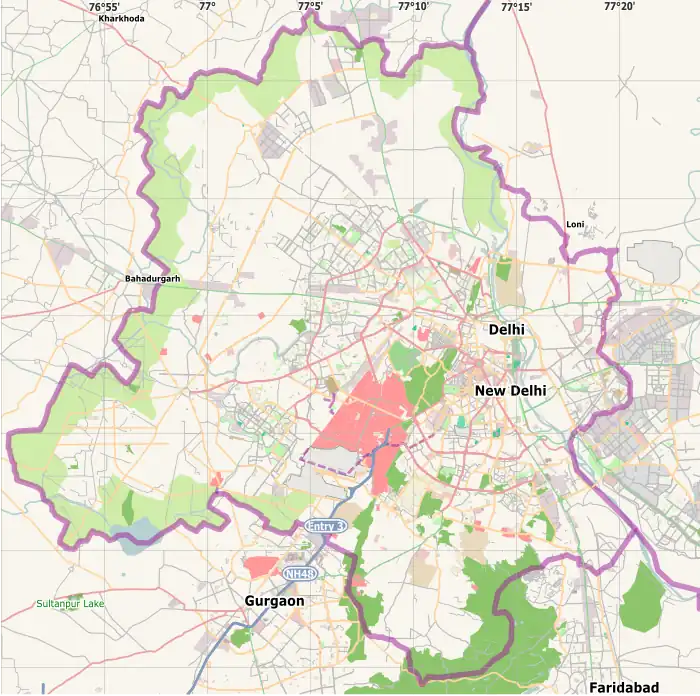  Pul Pehladpur Location in India | |
| Coordinates: 28°29′52″N 77°17′41″E / 28.49778°N 77.29472°E | |
| Country |  India India |
| State | Delhi |
| District | South East Delhi |
| Tehsil | Kalkaji[1] |
| Population (2011) | |
| • Total | 69,657 |
| Languages | |
| • Official | Hindi, English |
| Time zone | UTC+5:30 (IST) |
| PIN | 110044 |
| Lok Sabha constituency | South Delhi |
| Vidhan Sabha constituency | Tughlakabad |
| Civic agency | MCD |
Pul Pehladpur is a census town in South East Delhi district of Delhi, India.
Demographics
As of 2011 India Census,[2] Pul Pehladpur had a population of 69,657. Males constitute 54.5% of the population and females 45.5%. Pul Pehladpur has an average literacy rate of 84.4%, higher than the national average of 73%: male literacy is 91.28%, and female literacy is 76.23%. In Pul Pehladpur, 13.87% of the population is under 6 years of age.
Connectivity
Road
Pul Pehladpur is connected to the whole Delhi by M.B(Mehrauli-Badarpur)road.[3] It is also connected to Faridabad by Surajkund Road.[4]
Metro
The nearest metro stations are Tughlakabad and Badarpur Border on Violet Line, both of which are about 1 km from Pehladpur.[5]
Railway
The nearest railway station is Tughlakabad railway station.[6]
References
- ↑ "Subdivision & Blocks of South East Delhi". District South East.
- ↑ "Census of India 2011". Census Commission of India.
- ↑ "Pul Prahladpur, located on Mehrauli Badarpur (MB) Road". The Print. Retrieved 21 July 2022.
- ↑ "Surajkund Road". geoIQ. Retrieved 21 July 2022.
- ↑ "Nearest Metro Stations to Pul Pehladpur". delhimetroroute.in.
- ↑ "Nearest Railway Stations to Pul Pehladpur". roaddistance.in.
This article is issued from Wikipedia. The text is licensed under Creative Commons - Attribution - Sharealike. Additional terms may apply for the media files.