| Punta Izopo National Park | |
|---|---|
 | |
| Location | Northern Honduras |
| Nearest city | Tela |
| Coordinates | 15°48′51″N 87°22′59″W / 15.81417°N 87.38306°W[1] |
| Area | 112 km2 (43 sq mi)[1] |
| Established | 1 January 1992[1] |
| Official name | Refugio de Vida Silvestre Punta Izopo |
| Designated | 20 March 1996 |
| Reference no. | 812[2] |
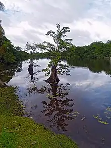
Punta Izopo National Park (Spanish: Parque Nacional Punta Izopo) is a national park located in the municipality of Tela, on the northern Caribbean coast of the Atlántida department of Honduras.[3] It has an altitude of 118 metres.[1]
References
- 1 2 3 4 "Honduras - Punta Izopo". United Nations Environment Programme. Retrieved 1 March 2010.
- ↑ "Refugio de Vida Silvestre Punta Izopo". Ramsar Sites Information Service. Retrieved 25 April 2018.
- ↑ Punta Izopo in Honduras Protected Planet
External links
This article is issued from Wikipedia. The text is licensed under Creative Commons - Attribution - Sharealike. Additional terms may apply for the media files.