Pursglove, West Virginia | |
|---|---|
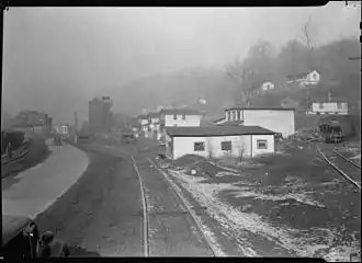 Pursglove in 1937. | |
 Pursglove, West Virginia  Pursglove, West Virginia | |
| Coordinates: 39°40′03″N 80°01′34″W / 39.66750°N 80.02611°W | |
| Country | |
| State | |
| County | |
| Elevation | 282 m (925 ft) |
| Time zone | UTC-5 (Eastern (EST)) |
| • Summer (DST) | UTC-4 (EDT) |
| ZIP code | 26546 |
| Area code(s) | 304 & 681 |
| GNIS feature ID | 1555424[1] |
Pursglove is an unincorporated community in Monongalia County, West Virginia, United States and one of the communities that make up the Scotts Run region. Pursglove is located on U.S. Route 19, 4.5 miles (7.2 km) northwest of downtown Morgantown. Pursglove has a post office with ZIP code 26546.[2]
Gallery of photos from Pursglove in the 1940s
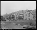 Pursglove #2 Mine housing
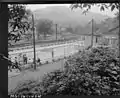 Miner's Memorial Swimming Pool
 School, June 1946
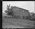 Settlement house
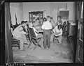 Sunday school in the house
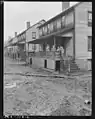 Children on porch after 1946 flood
See also
Wikimedia Commons has media related to Pursglove, West Virginia.
References

This article is issued from Wikipedia. The text is licensed under Creative Commons - Attribution - Sharealike. Additional terms may apply for the media files.