Route 191 | ||||
|---|---|---|---|---|
 | ||||
| Route information | ||||
| Length | 15.3 km[1] (9.5 mi) | |||
| Existed | 2009–present | |||
| Major junctions | ||||
| South end | ||||
| North end | ||||
| Location | ||||
| Country | Canada | |||
| Province | Quebec | |||
| Major cities | Cacouna, Rivière-du-Loup | |||
| Highway system | ||||
| ||||

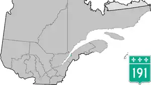
Quebec Route 191 is a provincial highway in the Canadian province of Quebec. This route provides a link connecting Quebec Autoroute 20 and Quebec Autoroute 85 from Rivière-du-Loup and Cacouna and a direct link for areas east of Rivière-du-Loup towards the southern part of the Bas-Saint-Laurent region, New Brunswick and Maine.[2]
Towns along Route 191
Major intersections
The entire route is in Rivière-du-Loup RCM.
| Location | km[1] | mi | Destinations | Notes | |
|---|---|---|---|---|---|
| Rivière-du-Loup | 0.0 | 0.0 | R-191 southern terminus; A-85 exit 93 | ||
| 1.0 | 0.62 | Rue Témiscouata – Rivière-du-Loup (Centre-Ville) | |||
| 7.0 | 4.3 | South end of R-291 concurrency | |||
| Cacouna | 11.8 | 7.3 | North end of R-291 concurrency | ||
| 13.3 | 8.3 | R-191 northern terminus; A-20 exit 514 | |||
| 15.3 | 9.5 | ||||
1.000 mi = 1.609 km; 1.000 km = 0.621 mi
| |||||
References
- 1 2 Google (March 30, 2023). "Route 191 in Quebec" (Map). Google Maps. Google. Retrieved March 30, 2023.
- ↑ http://www.mtq.gouv.qc.ca/portal/page/portal/Librairie/Publications/fr/salle_presse/20080211_investissements2008_2009/investissements_bas_st_laurent.pdf]
External links
This article is issued from Wikipedia. The text is licensed under Creative Commons - Attribution - Sharealike. Additional terms may apply for the media files.