Raasdorf | |
|---|---|
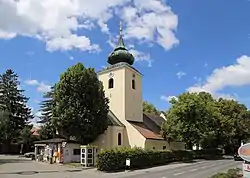 Raasdorf parish church | |
 Raasdorf Location within Austria | |
| Coordinates: 48°15′N 16°34′E / 48.250°N 16.567°E | |
| Country | Austria |
| State | Lower Austria |
| District | Gänserndorf |
| Government | |
| • Mayor | Walter Krutis |
| Area | |
| • Total | 13.21 km2 (5.10 sq mi) |
| Elevation | 156 m (512 ft) |
| Population (2018-01-01)[2] | |
| • Total | 645 |
| • Density | 49/km2 (130/sq mi) |
| Time zone | UTC+1 (CET) |
| • Summer (DST) | UTC+2 (CEST) |
| Postal code | 2281 |
| Area code | 02249 |
| Website | www.raasdorf.at |
Raasdorf is a town in the district of Gänserndorf in the Austrian state of Lower Austria.[3]
Geography
Raasdorf lies in the Weinviertel in Lower Austria. Only about 0.84 percent of the municipality is forested.
References
- ↑ "Dauersiedlungsraum der Gemeinden Politischen Bezirke und Bundesländer - Gebietsstand 1.1.2018". Statistics Austria. Retrieved 10 March 2019.
- ↑ "Einwohnerzahl 1.1.2018 nach Gemeinden mit Status, Gebietsstand 1.1.2018". Statistics Austria. Retrieved 9 March 2019.
- ↑ Sladek, Maria (2023-02-19). "Lower Austria: Discover the Heart of Austria's History and Culture". Vienna Times | European English Newspaper. Retrieved 2023-12-17.
This article is issued from Wikipedia. The text is licensed under Creative Commons - Attribution - Sharealike. Additional terms may apply for the media files.