Radfeld | |
|---|---|
 | |
 Coat of arms | |
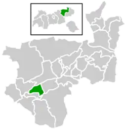 Location within Kufstein district | |
 Radfeld Location within Austria | |
| Coordinates: 47°26′46″N 11°54′41″E / 47.44611°N 11.91139°E | |
| Country | Austria |
| State | Tyrol |
| District | Kufstein |
| Government | |
| • Mayor | Josef Auer (Zukunft für Radfeld) |
| Area | |
| • Total | 14.32 km2 (5.53 sq mi) |
| Elevation | 512 m (1,680 ft) |
| Population (2018-01-01)[2] | |
| • Total | 2,495 |
| • Density | 170/km2 (450/sq mi) |
| Time zone | UTC+1 (CET) |
| • Summer (DST) | UTC+2 (CEST) |
| Postal code | 6241 |
| Area code | +43 5337 |
| Vehicle registration | KU |
| Website | www.radfeld.tirol.gv.at |
Radfeld is a municipality in the Kufstein district in the Austrian state of Tyrol located 1 km east of the town of Rattenberg, 13 km west of Wörgl, and 24 km southwest of Kufstein.

Radfeld, chapel: die Schützenkapelle Herz-Jesu in der Au
References
- ↑ "Dauersiedlungsraum der Gemeinden Politischen Bezirke und Bundesländer - Gebietsstand 1.1.2018". Statistics Austria. Retrieved 10 March 2019.
- ↑ "Einwohnerzahl 1.1.2018 nach Gemeinden mit Status, Gebietsstand 1.1.2018". Statistics Austria. Retrieved 9 March 2019.
Wikimedia Commons has media related to Radfeld.
This article is issued from Wikipedia. The text is licensed under Creative Commons - Attribution - Sharealike. Additional terms may apply for the media files.