Radon | |
|---|---|
Part of Écouves | |
Location of Radon | |
 Radon  Radon | |
| Coordinates: 48°30′14″N 0°06′09″E / 48.5039°N 0.1025°E | |
| Country | France |
| Region | Normandy |
| Department | Orne |
| Arrondissement | Alençon |
| Canton | Radon |
| Commune | Écouves |
| Area 1 | 19.81 km2 (7.65 sq mi) |
| Population (2019)[1] | 1,036 |
| • Density | 52/km2 (140/sq mi) |
| Time zone | UTC+01:00 (CET) |
| • Summer (DST) | UTC+02:00 (CEST) |
| Postal code | 61250 |
| Elevation | 148–345 m (486–1,132 ft) (avg. 180 m or 590 ft) |
| 1 French Land Register data, which excludes lakes, ponds, glaciers > 1 km2 (0.386 sq mi or 247 acres) and river estuaries. | |
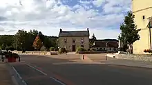
Mairie de Radon
Radon (French pronunciation: [ʁadɔ̃] ⓘ) is a former commune in the Orne department in north-western France. On 1 January 2016, it was merged into the new commune of Écouves.[2] It is around 7 km north of Alençon.
Notable buildings and places
National heritage sites
- Markers of Forêt d'Écouves a set of 80 markers positioned in the 18th century that mark the boundaries of the forest, they were registered as a Monument historique in 1987.[3]
See also
References
- ↑ Téléchargement du fichier d'ensemble des populations légales en 2019, INSEE
- ↑ Arrêté préfectoral 29 September 2015 (in French)
- ↑ "80 bornes de la forêt d'Ecouves (également sur communes de Le Bouillon, La Chapelle-près-Sées, La Ferrière-Béchet, Fontenai-les-Louvets, La Lande-de-Goult, Radon, Rouperroux, Saint-Didier-sous-Ecouves, Saint-Gervais-du-Perron, Tanville et Vingt-Hanap..." monumentum.fr.
Wikimedia Commons has media related to Radon (Orne).
This article is issued from Wikipedia. The text is licensed under Creative Commons - Attribution - Sharealike. Additional terms may apply for the media files.