Rantechaux | |
|---|---|
Part of Les Premiers-Sapins | |
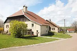 Farm building in Rantechaux | |
Location of Rantechaux | |
 Rantechaux  Rantechaux | |
| Coordinates: 47°06′46″N 6°22′33″E / 47.1128°N 6.3758°E | |
| Country | France |
| Region | Bourgogne-Franche-Comté |
| Department | Doubs |
| Arrondissement | Pontarlier |
| Canton | Valdahon |
| Commune | Les Premiers-Sapins |
| Area 1 | 5.71 km2 (2.20 sq mi) |
| Population (2019)[1] | 181 |
| • Density | 32/km2 (82/sq mi) |
| Time zone | UTC+01:00 (CET) |
| • Summer (DST) | UTC+02:00 (CEST) |
| Postal code | 25580 |
| Elevation | 718–863 m (2,356–2,831 ft) (avg. 750 m or 2,460 ft) |
| 1 French Land Register data, which excludes lakes, ponds, glaciers > 1 km2 (0.386 sq mi or 247 acres) and river estuaries. | |
Rantechaux (French pronunciation: [ʁɑ̃təʃo]) is a former commune in the Doubs department in the Bourgogne-Franche-Comté region in eastern France.
History
On 1 January 2016, Athose, Chasnans, Hautepierre-le-Châtelet, Nods, Rantechaux and Vanclans merged becoming one commune called Les Premiers-Sapins.
Population
| Year | Pop. | ±% |
|---|---|---|
| 1962 | 128 | — |
| 1968 | 136 | +6.2% |
| 1975 | 101 | −25.7% |
| 1982 | 120 | +18.8% |
| 1990 | 135 | +12.5% |
| 1999 | 186 | +37.8% |
| 2008 | 190 | +2.2% |
| 2012 | 184 | −3.2% |
See also
References
Wikimedia Commons has media related to Rantechaux.
This article is issued from Wikipedia. The text is licensed under Creative Commons - Attribution - Sharealike. Additional terms may apply for the media files.