Raseiniai District Municipality
Raseinių rajono savivaldybė | |
|---|---|
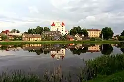 Pond near Raseiniai | |
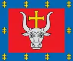
 Coat of arms | |
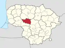 Location of Raseiniai district municipality within Lithuania | |
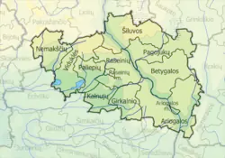 Map of Raseiniai district municipality | |
| Country | |
| Ethnographic region | Samogitia |
| County | |
| Capital | Raseiniai |
| Elderships | 12 |
| Area | |
| • Total | 1,573 km2 (607 sq mi) |
| • Rank | 12th |
| Population (2021[1]) | |
| • Total | 31,192 |
| • Rank | 23-24th |
| • Density | 20/km2 (51/sq mi) |
| • Rank | 34-35th |
| Time zone | UTC+2 (EET) |
| • Summer (DST) | UTC+3 (EEST) |
| Telephone code | 428 |
| Major settlements | |
| Website | www |
Raseiniai District Municipality is one of 60 municipalities in Lithuania.
Symbols
Coat of arms: A traditional Iberic shield Argent, resting on a base Vert a lynx salient Proper.
References
55°23′49″N 23°09′40″E / 55.39694°N 23.16111°E
This article is issued from Wikipedia. The text is licensed under Creative Commons - Attribution - Sharealike. Additional terms may apply for the media files.