Telšiai District Municipality
Telšių rajono savivaldybė | |
|---|---|
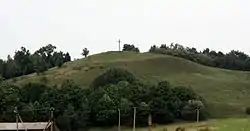 Burbiškiai mound | |
 Coat of arms | |
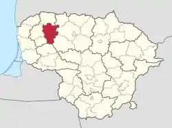 Location of Telšiai district municipality within Lithuania | |
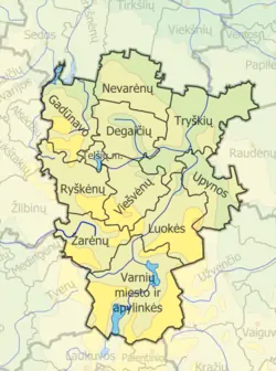 Map of Telšiai district municipality | |
| Coordinates: 55°53′17″N 22°23′38″E / 55.88806°N 22.39389°E | |
| Country | |
| Ethnographic region | Samogitia |
| County | Telšiai County |
| Capital | Telšiai |
| Elderships | 11 |
| Area | |
| • Total | 1,439 km2 (556 sq mi) |
| • Rank | 18-19th |
| Population (2021[1]) | |
| • Total | 40,210 |
| • Rank | 12th |
| • Density | 28/km2 (72/sq mi) |
| • Rank | 20th |
| Time zone | UTC+2 (EET) |
| • Summer (DST) | UTC+3 (EEST) |
| Telephone code | 444 |
| Major settlements | |
| Website | www |
Telšiai District Municipality (Lithuanian: Telšių rajono savivaldybė, Samogitian: Telšiū rajuona savivaldībė) is one of 60 municipalities in Lithuania, containing the city of Telšiai.
References
| Municipalities |  | |
|---|---|---|
| Cities | ||
| Towns | ||
| Villages | ||
This article is issued from Wikipedia. The text is licensed under Creative Commons - Attribution - Sharealike. Additional terms may apply for the media files.