Rastislavice | |
|---|---|
Municipality | |
 | |
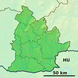 Rastislavice Location of Rastislavice in the Nitra Region 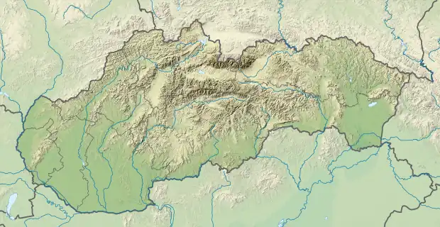 Rastislavice Location of Rastislavice in Slovakia | |
| Coordinates: 48°08′12″N 18°04′29″E / 48.13667°N 18.07472°E | |
| Country | |
| Region | Nitra |
| District | Nové Zámky |
| First mentioned | 1936 |
| Area | |
| • Total | 19.589 km2 (7.563 sq mi) |
| Elevation | 124 m (407 ft) |
| Population | |
| • Total | 920 |
| • Density | 47/km2 (120/sq mi) |
| Time zone | UTC+1 (CET) |
| • Summer (DST) | UTC+2 (CEST) |
| Postal code | 941 10 (pošta Tvrdošovce) |
| Area code | 421-35 |
| Car plate | NZ |
| Website | www.obecrastislavice.sk |
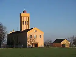
Rastislavice (Hungarian: Dögös) is a village and municipality in the Nové Zámky District in the Nitra Region of south-west Slovakia.
History
The village is new built in 1936.
Geography
The village lies at an altitude of 124 metres and covers an area of 19.589 km². It has a population of about 920 people.
Ethnicity
 Slovaks 99%
 Hungarians 1%
Facilities
External links
 Media related to Rastislavice at Wikimedia Commons
- Official website

- http://www.statistics.sk/mosmis/eng/run.html
- Rastislavice – Nové Zámky Okolie
official web site of the village:
This article is issued from Wikipedia. The text is licensed under Creative Commons - Attribution - Sharealike. Additional terms may apply for the media files.